10 Remarkable Photography Locations in Northern Norway
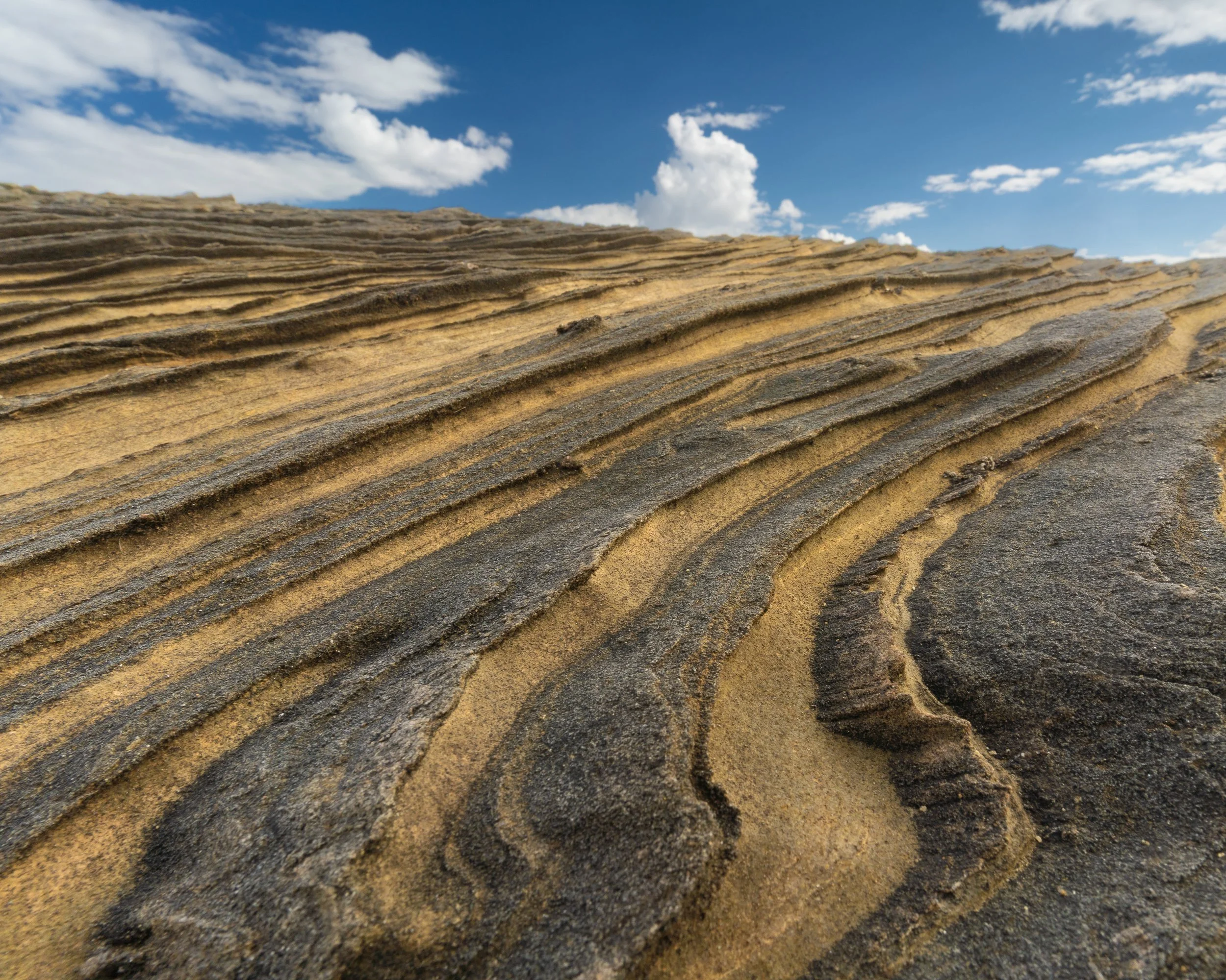
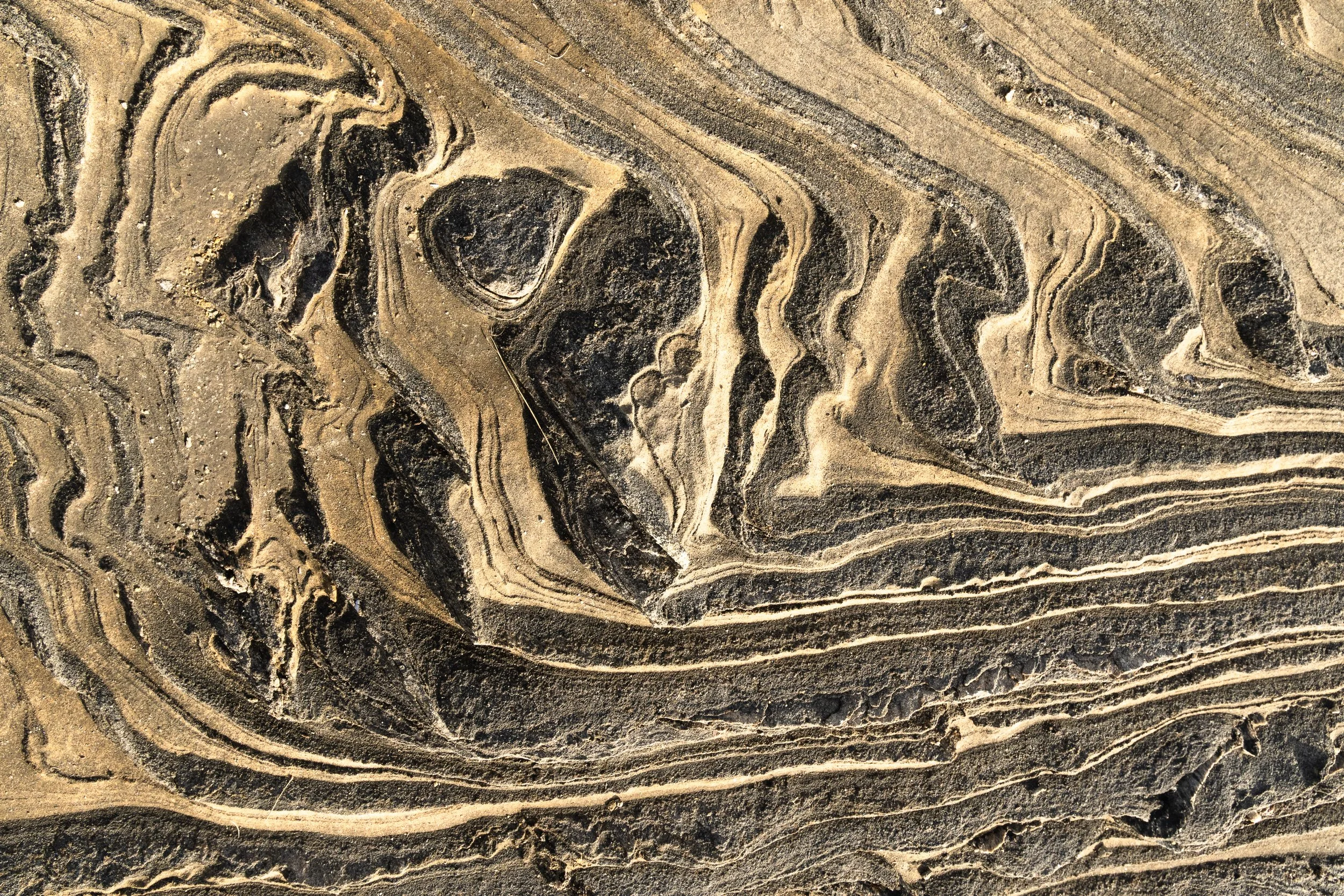
Láhko National Park: Karst formations in Láhko National Park, where water and time have sculpted the limestone into intricate, flowing patterns across the plateau.
Northern Norway is often described in superlatives: dramatic, wild, untouched. While those descriptions are not inaccurate, they only tell part of the story. What defines this region photographically is not just its scale, but its range.
Within relatively short distances, the landscape shifts between entirely different visual languages. You move from glaciers to coastlines, from open alpine terrain to dense botanical environments, and from natural forms to the remnants of industrial history. For photographers, this creates a rare opportunity: not just to capture landscapes, but to explore multiple disciplines within a single region.
The Monumental and the intimate
A key factor behind this diversity is the geology. Much of Nordland is shaped by calcareous bedrock, which supports a rich and often uncommon plant life. In certain areas, this transforms the photographic experience. What might initially appear as a grand landscape reveals, on closer inspection, an intricate world of textures, structures, and botanical detail.
This interplay between the monumental and the intimate defines Northern Norway. The locations below are not simply scenic viewpoints, but places that invite different ways of seeing and different ways of working.
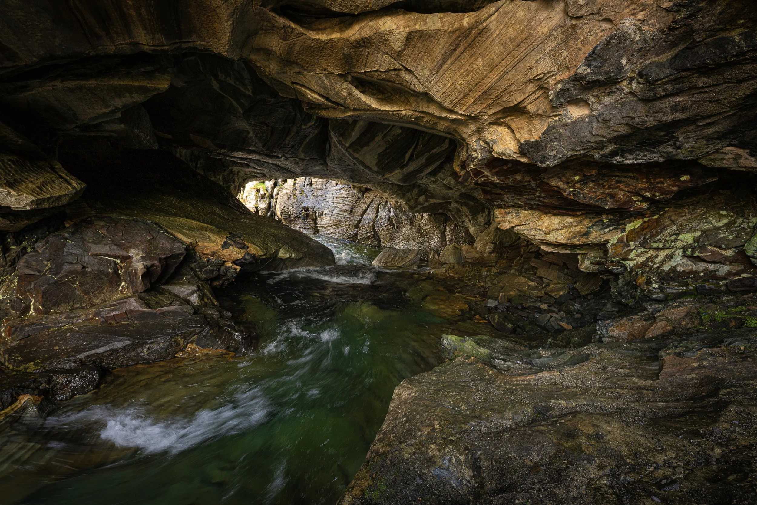
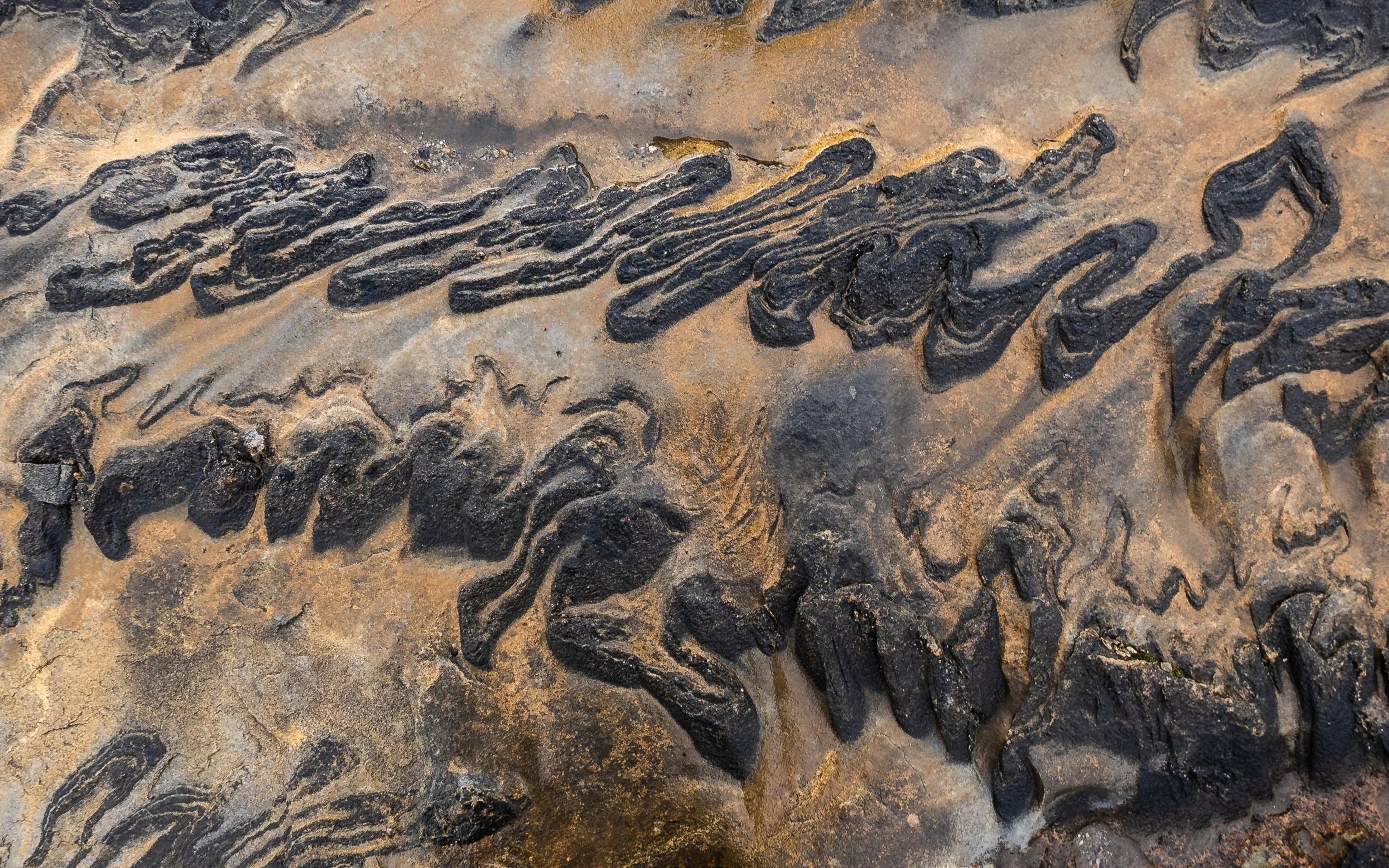
Láhko National Park: A karst cave in Láhko National Park, where water has carved hidden chambers and sculptural forms into the limestone over time. (Sony a7R II and Sigma 14mm f/1.8 DG HSM Art at 1/10 sec, f/10.) Photo: Bjørn Joachimsen.
1. Marmorslottet
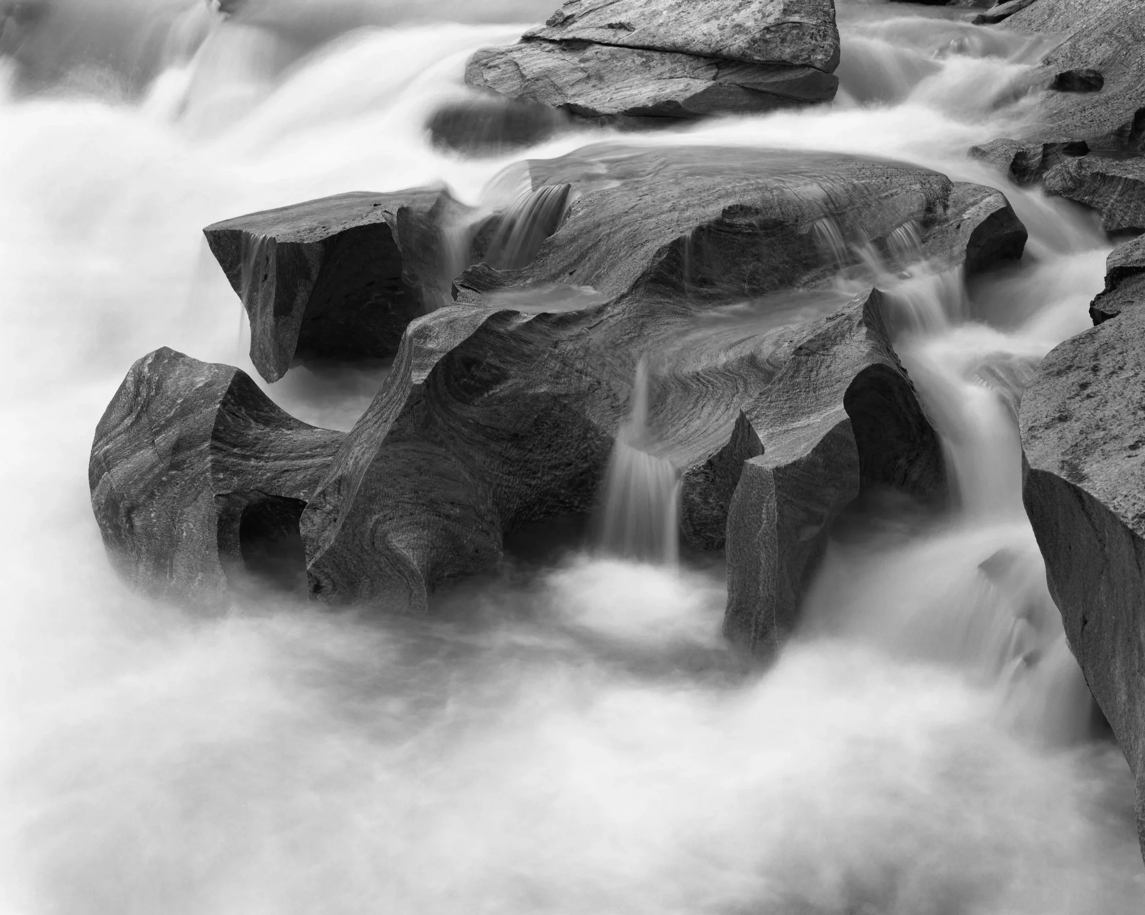
Marmorslottet is a spectacular geological formation located in the river Glomåga in Rana, Nordland, inside the protected area of Fisktjønna Nature Reserve.
Over time, the river has carved the marble into a series of smooth, sculptural forms — natural basins, small caves, and flowing channels shaped by erosion. The combination of polished white stone and turquoise water gives the area a distinctly surreal quality that is difficult to translate directly into conventional landscape imagery.
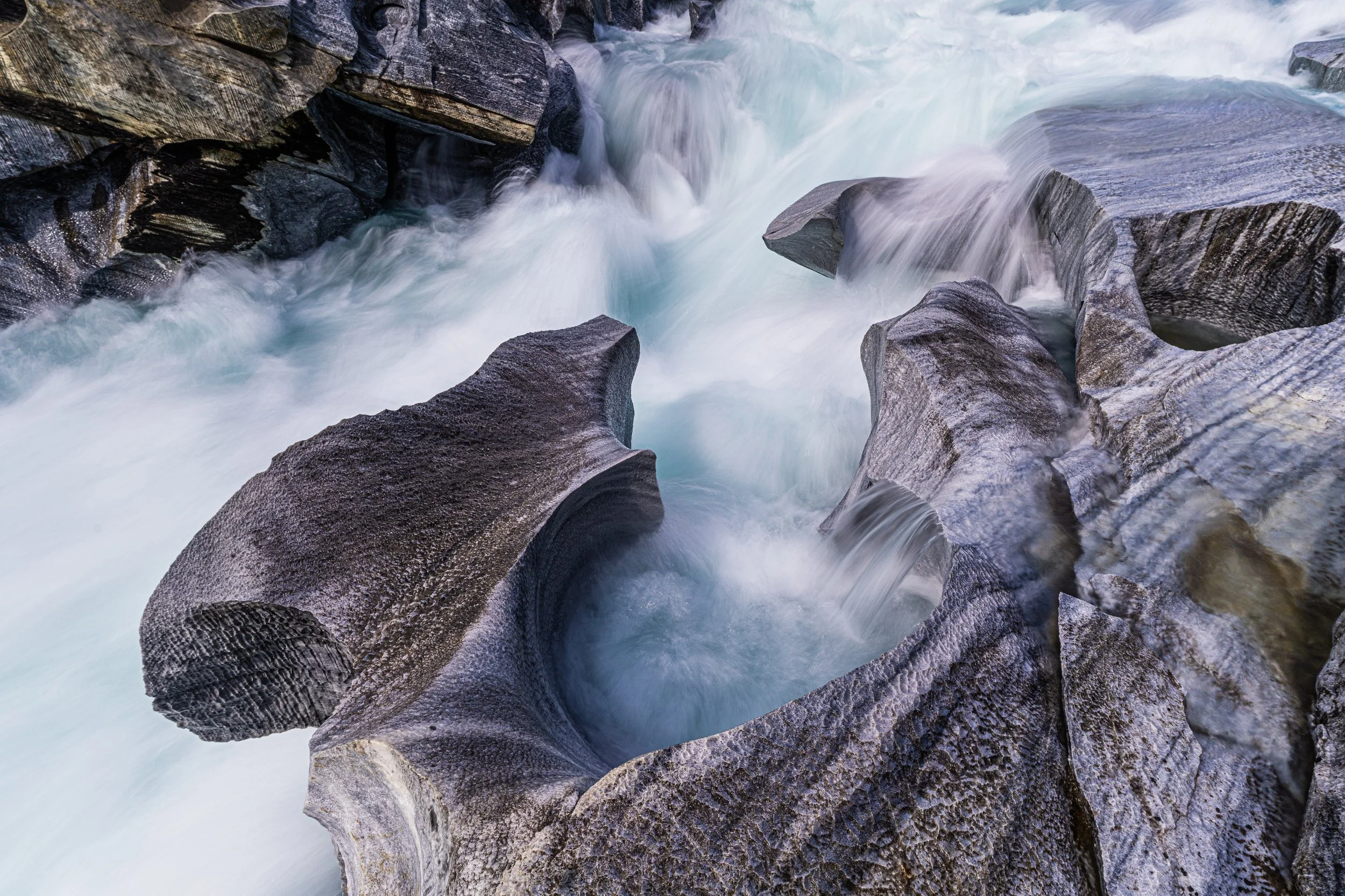
Marmorslottet: Marble formations in the Glomåga River, where flowing water has sculpted smooth, white limestone into organic shapes and channels. (Sony a7R II and Zeiss Batis 18mm f/2.8 at 1/15 sec, f/11, using a NiSi V7 100mm filter system with ND8.) Photo: Bjørn Joachimsen.
Despite its visual impact, Marmorslottet rarely works as a traditional wide composition. The formations resist scale. Instead, the strongest images emerge when you move closer — isolating curves, following lines, and working with repetition and structure. Tight compositions can be very effective even with a wide-angle lens, as long as you work at close range.
The background can sometimes become distracting, so a tripod that allows for a slightly elevated camera position can be very useful. By tilting the camera downward toward the formations, you can create more refined and abstract interpretations of the scene.
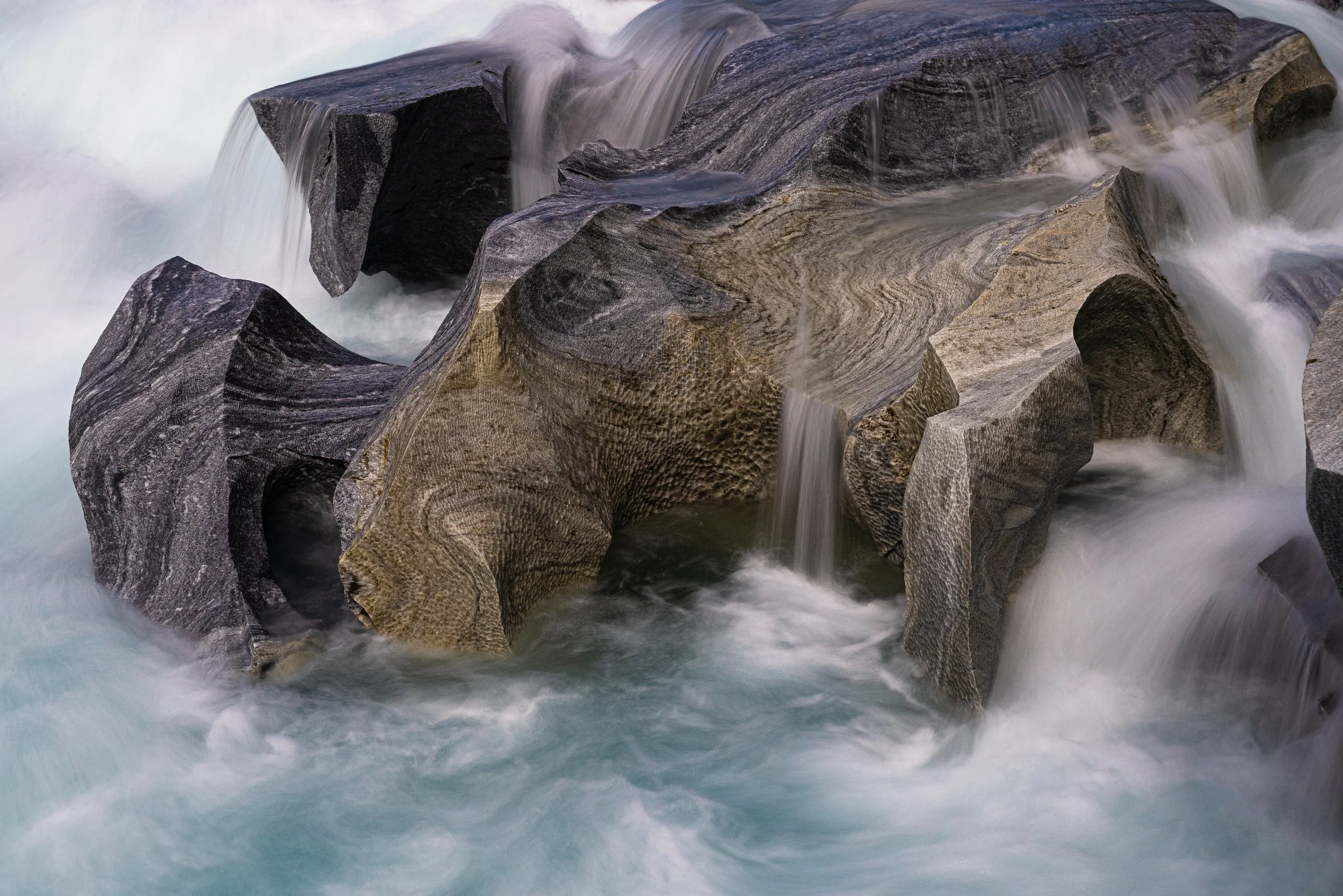
Marmorslottet: Marble formations in the Glomåga River, where flowing water has carved smooth, sculptural shapes into the limestone. This unique landscape is especially well suited for intimate landscape photography, allowing you to work closely with lines, textures, and subtle variations in form rather than wide, sweeping views. Photo: Bjørn Joachimsen.
Water movement plays a defining role. Long exposures can simplify the image, but timing is critical. Exposures that are too long will remove texture and the sense of movement. In many cases, shutter speeds around 1/8 second provide a good balance. A neutral density filter in the range of ND8 to ND64 is highly recommended.
Since crossing the river is not possible, it is also useful to have focal lengths up to around 100mm, or longer, on full frame, to access compositions on the opposite side.
Safety is critical. The current in the river is often extremely strong, and a fall into the water can be fatal. Always remain aware of your surroundings.
2. Svartisen and Engenbreen
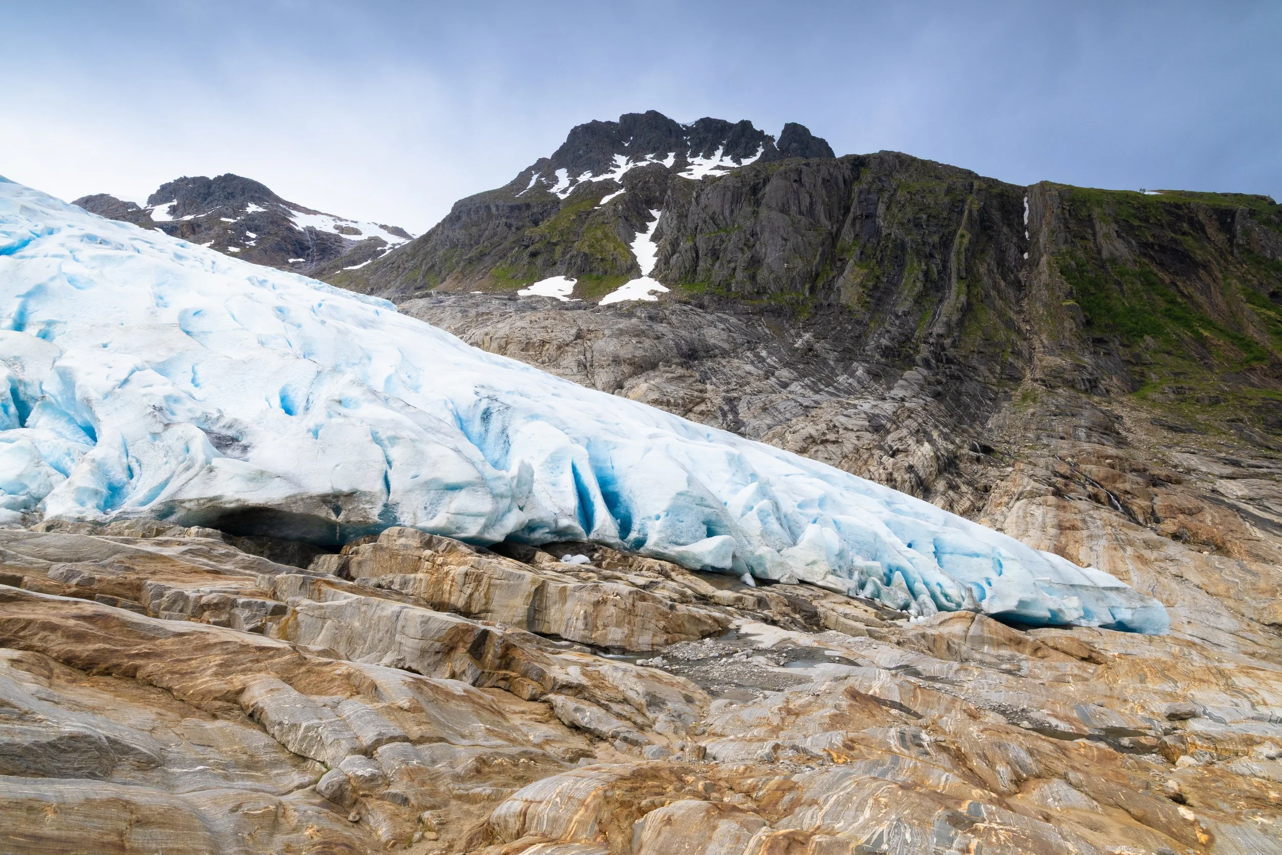
Svartisen and its glacier arm, Engenbreen, demonstrate how one location can support multiple photographic approaches — while also illustrating how dynamic these landscapes are.
Engenbreen, an outlet glacier from Vestre Svartisen in Meløy, has changed significantly in recent decades. It once covered Engabrevatnet, which became ice-free in the mid-1900s, and has retreated approximately 800 meters between 1999 and 2024.
Engenbreen: The glacier front of Engenbreen (Svartisen) descending into the landscape, where ice, rock, and meltwater meet in a constantly changing environment shaped by time and retreat. Photo: Bjørn Joachimsen.
The glacier spans elevations from around 600 to nearly 1,600 meters above sea level, with the front descending unusually low. From a distance, Svartisen presents a powerful large-scale subject defined by mass, light, and atmosphere.
Closer to Engenbreen, the visual language shifts toward detail — fractures, meltwater channels, and surface textures that lend themselves to more abstract compositions. The closer you get, the more raw and recently exposed the landscape becomes.
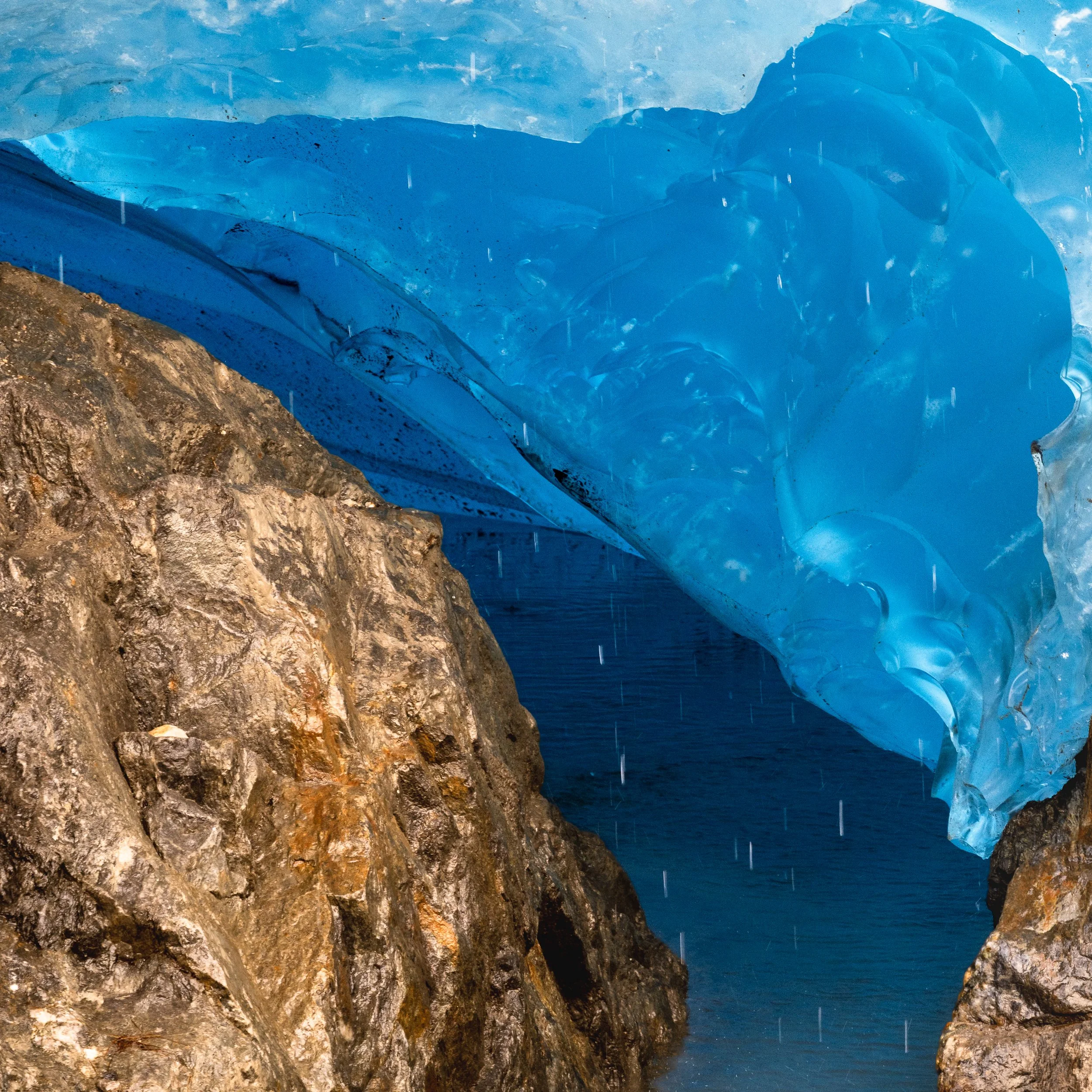
Engenbreen: A tight telephoto study of an ice cave within the glacier, where compressed ice reveals intricate textures, tones, and sculptural forms shaped by meltwater and pressure. (Pentax K-3 III and HD Pentax-DA 55–300mm f/4.5–6.3 at 150mm.) Photo: Bjørn Joachimsen.
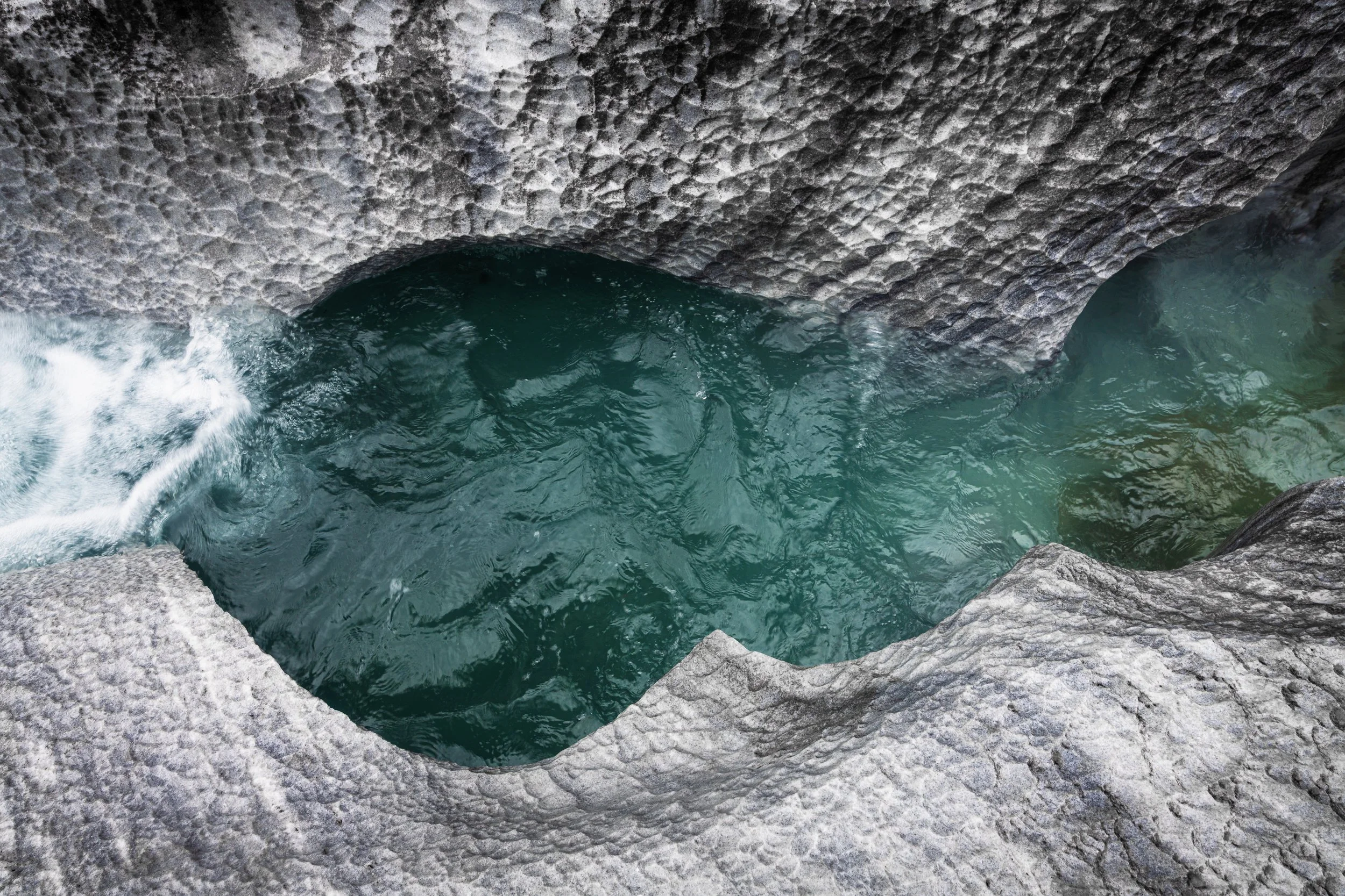
Below and alongside the glacier, you will find fascinating geological formations, textures, and colors. One of the most remarkable features is Svartisgryta — a massive glacial pothole containing several smaller ones within it. Take your time to find the best vantage point, preferably from higher ground opposite the formation.
Engenbreen: A massive glacial pothole revealed below Engenbreen, containing multiple smaller potholes within — a formation uncovered only in recent decades as the glacier has retreated. Photo: Bjørn Joachimsen.
Access requires a boat from Holandsvik, followed by walking or cycling. The terrain becomes steep toward the end, and it is strongly recommended to follow marked trails. The glacier front is dangerous — ice can calve suddenly and without warning. Large ice blocks falling from the glacier can be fatal.
A telephoto lens up to 200mm (full frame) or longer is highly recommended.
3. Láhko National Park
Láhko National Park is one of the least immediately dramatic — and therefore most demanding — landscapes in Northern Norway.
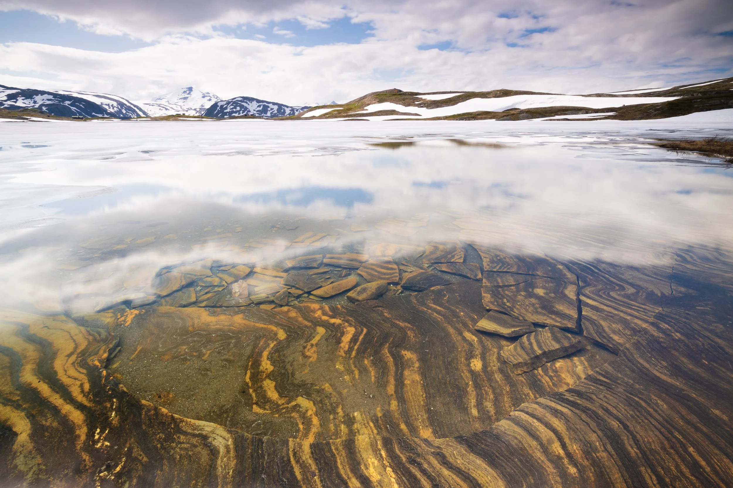
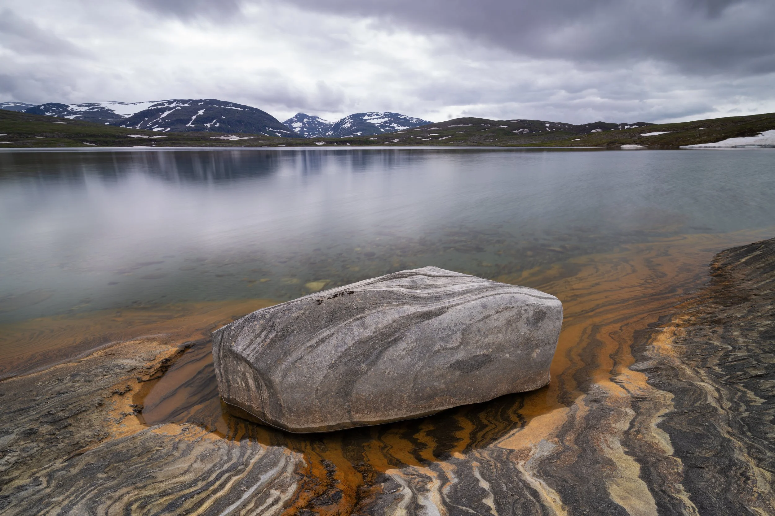
Láhko National Park: Submerged karst formations visible on the lakebed, where clear water reveals the intricate patterns shaped in the limestone below the surface. (Pentax K-3 III and HD Pentax-DA 11–18mm f/2.8 ED DC AW, using a NiSi V7 100mm system with ND64, TrueColor CPL, and GND 0.9.) Photo: Bjørn Joachimsen.
Established in 2012 and covering 188 square kilometers across Beiarn, Gildeskål, and Meløy, it protects Norway’s largest continuous area of alpine karst terrain.
The name Láhko means “a high, open plateau.” Much of the park lies above the tree line, shaped by dissolution processes in the limestone bedrock. The result is a landscape defined by subtle variation rather than dominant features.
Walking into Láhko feels like stepping into a vast natural sculpture. The terrain continuously presents new compositions. The challenge is not finding subjects — it is choosing between them.
For photographers, discipline becomes essential. It is easy to become overwhelmed by possibilities. The key is to slow down, work selectively, and commit to each composition.
To get the most out of Láhko, at least two days are recommended. One day can be spent working from Navnlaushøgda toward Fiskvannskaret. Another can take you deeper into areas such as Corbel’s Canyon, where karst caves and erosion channels create highly structured compositions.
Start early to make full use of the day. A tripod is essential, and a focal range from wide-angle to approximately 200mm provides the necessary flexibility.
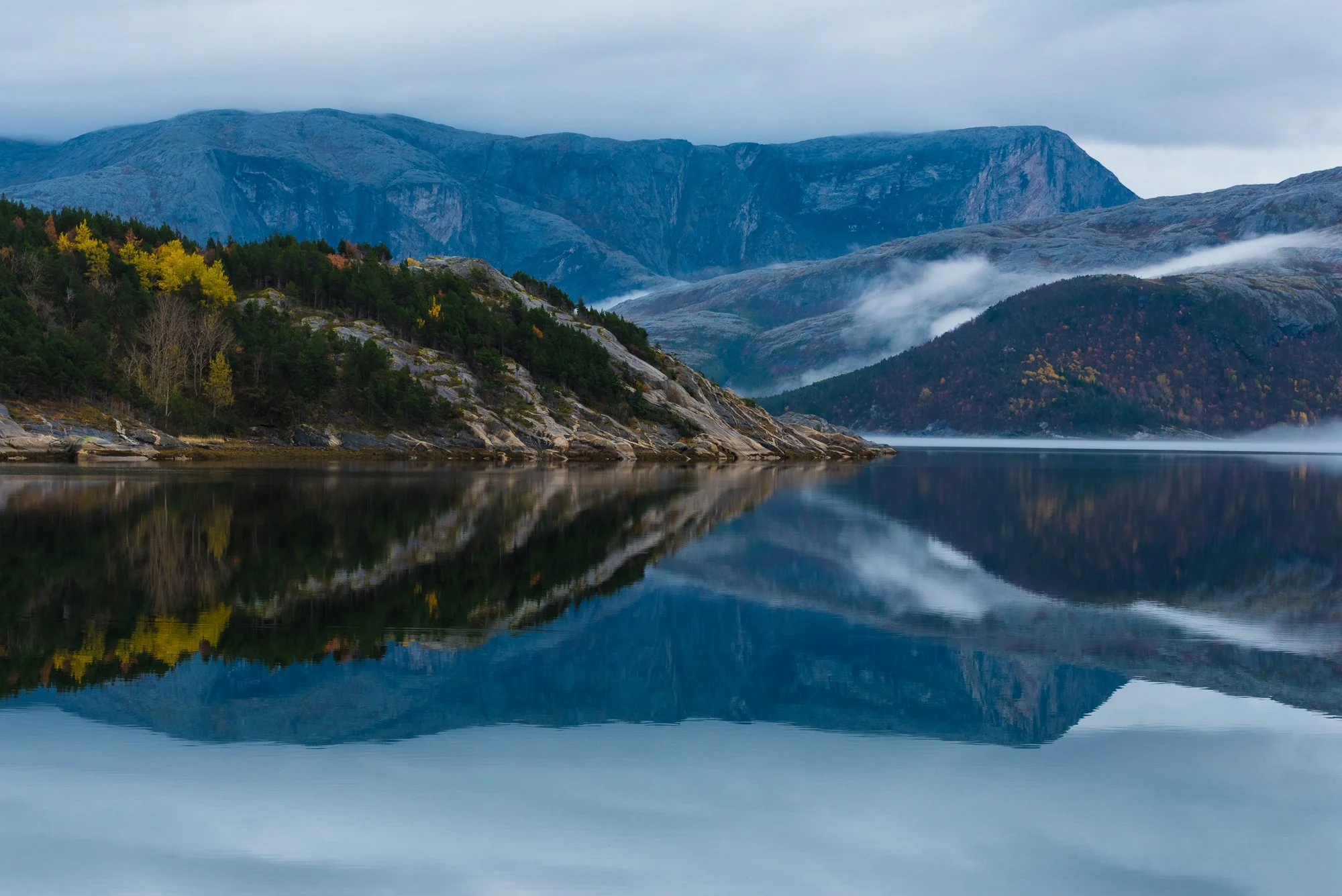
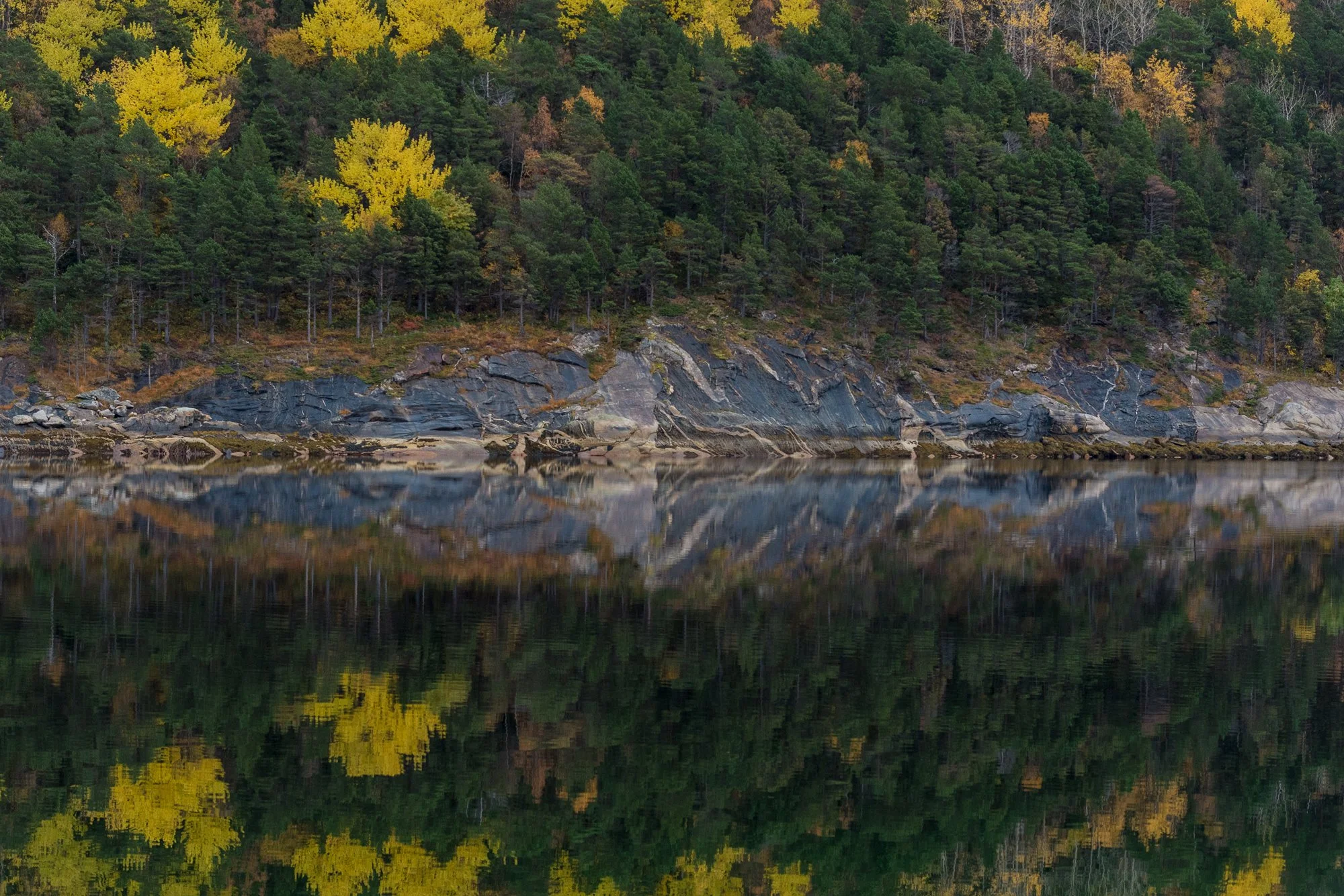
4. Gildeskål Coastline
The coastline in Gildeskål provides a dynamic and constantly changing environment.
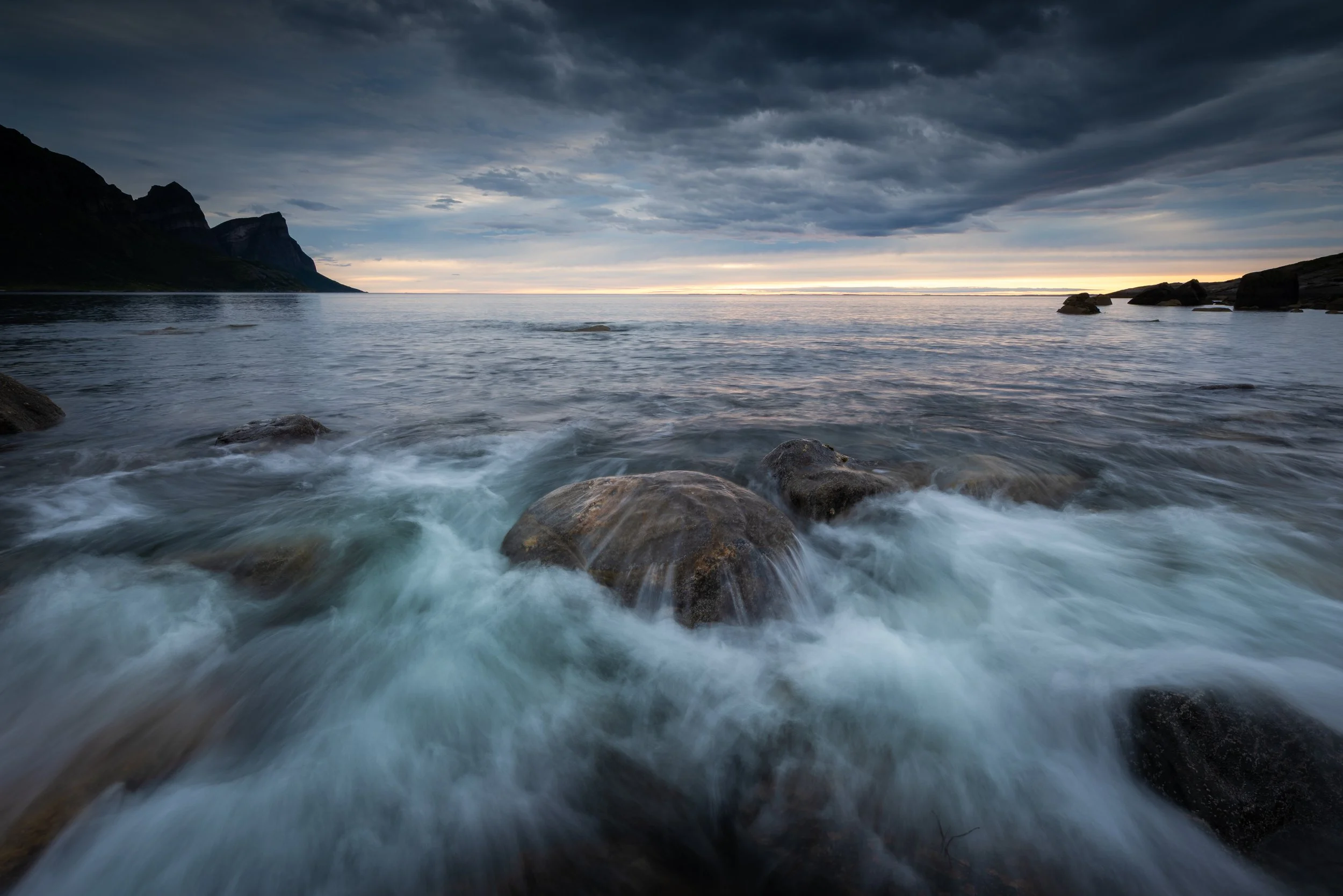
Gildeskål: Towering coastal cliffs rising above the landscape, with distant mountains in the background, photographed just before sunset when the light reveals form, depth, and atmosphere. Timing is essential to capture the scene at its most refined. Photo: Bjørn Joachimsen.
Waves, wind, and shifting light conditions require a responsive approach. Rock formations create strong foregrounds, while the sea introduces rhythm and movement.
Neutral density filters are extremely useful here, allowing you to emphasize the energy of the ocean through longer exposures. A tripod is essential.
Gildeskål: Ocean swells rolling in from the open sea break over rounded shoreline stones, creating a constant interplay of movement and texture. A solid tripod and a filter system with ND and graduated ND filters are essential for working effectively along the Northern Norway coastline. Photo: Bjørn Joachimsen.
Under calmer conditions, smaller details emerge — textures, pools, and subtle tonal transitions — offering a more restrained photographic approach.
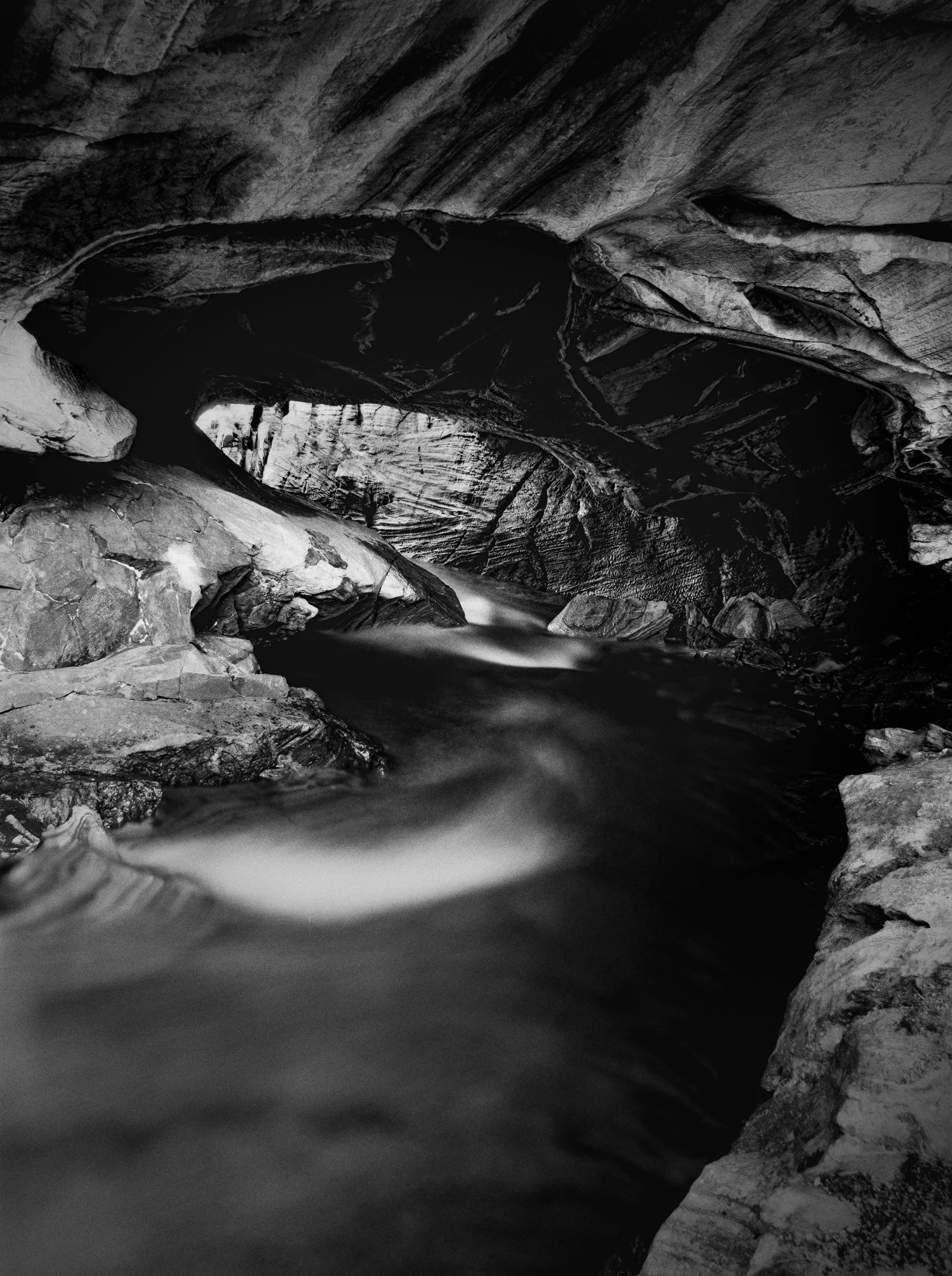
5. Sea Cave in Gildeskål
Caves such as Brenningshula (Børsteinshola) introduce a more structured photographic environment.
Located around 80 meters above the present sea level, the cave marks an ancient shoreline shaped by wave erosion. Its large, symmetrical opening creates a space that feels almost architectural in scale.
Inside, the scene becomes controlled. The opening frames the outside world, while the interior introduces darkness, texture, and depth. Light is limited and directional.
Sea Cave, Gildeskål: A vast sea cave formed during the last Ice Age, where late afternoon light illuminates the interior walls, revealing texture, depth, and sculptural detail. (Sony a7R II and Zeiss Batis 18mm f/2.8, using exposure bracketing and HDR merge in Lightroom Classic.) Photo: Bjørn Joachimsen.
A standard zoom lens such as 24–70mm is sufficient. A tripod is necessary, and exposure bracketing is highly recommended due to the extreme contrast between the interior and exterior light. HDR blending in post-processing can be very effective.
Be aware that photography restrictions may apply in the area due to nearby military activity, and identification checks may occur.
6. Saltdal and Junkerdal
This region offers one of the widest photographic ranges in Northern Norway.
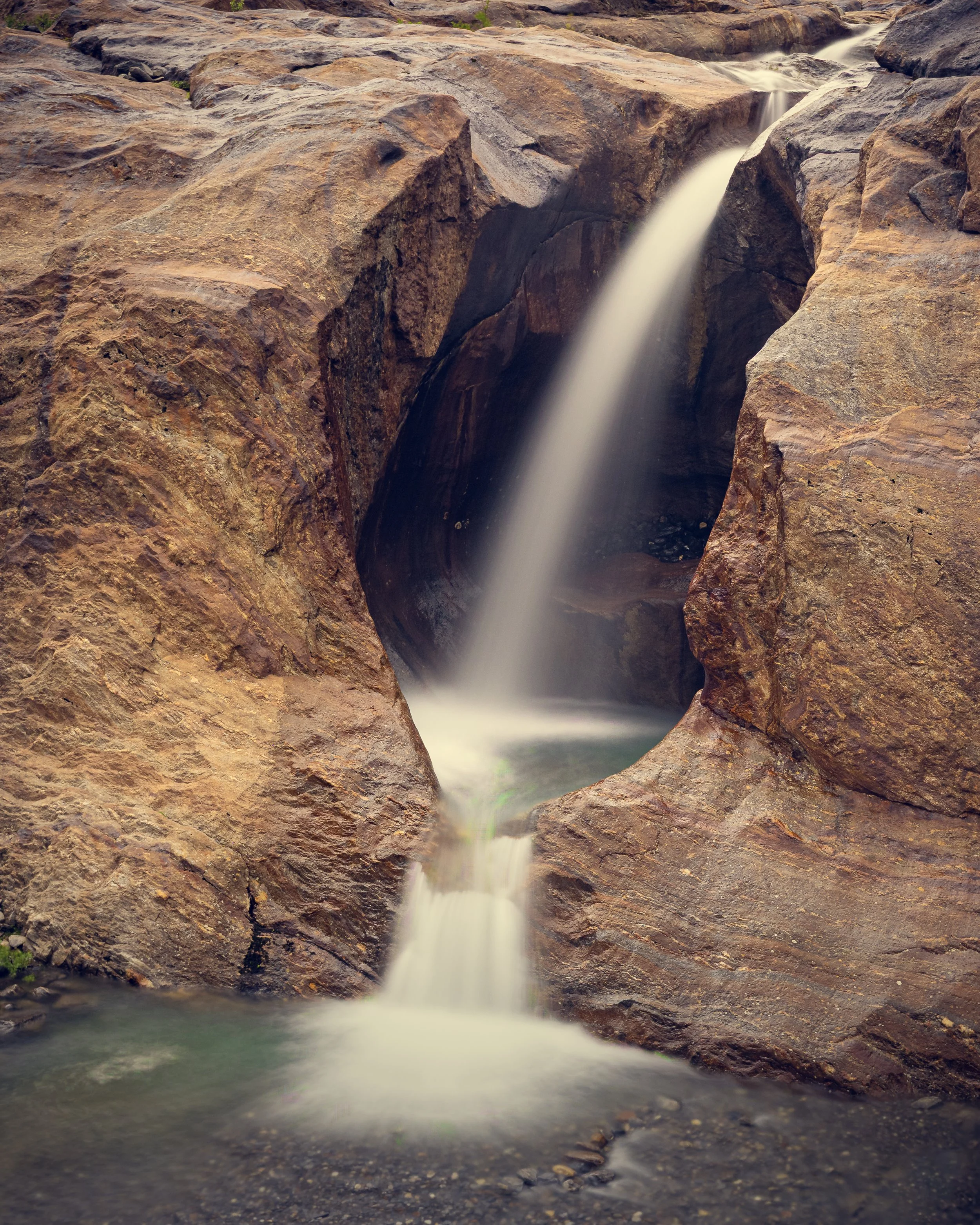
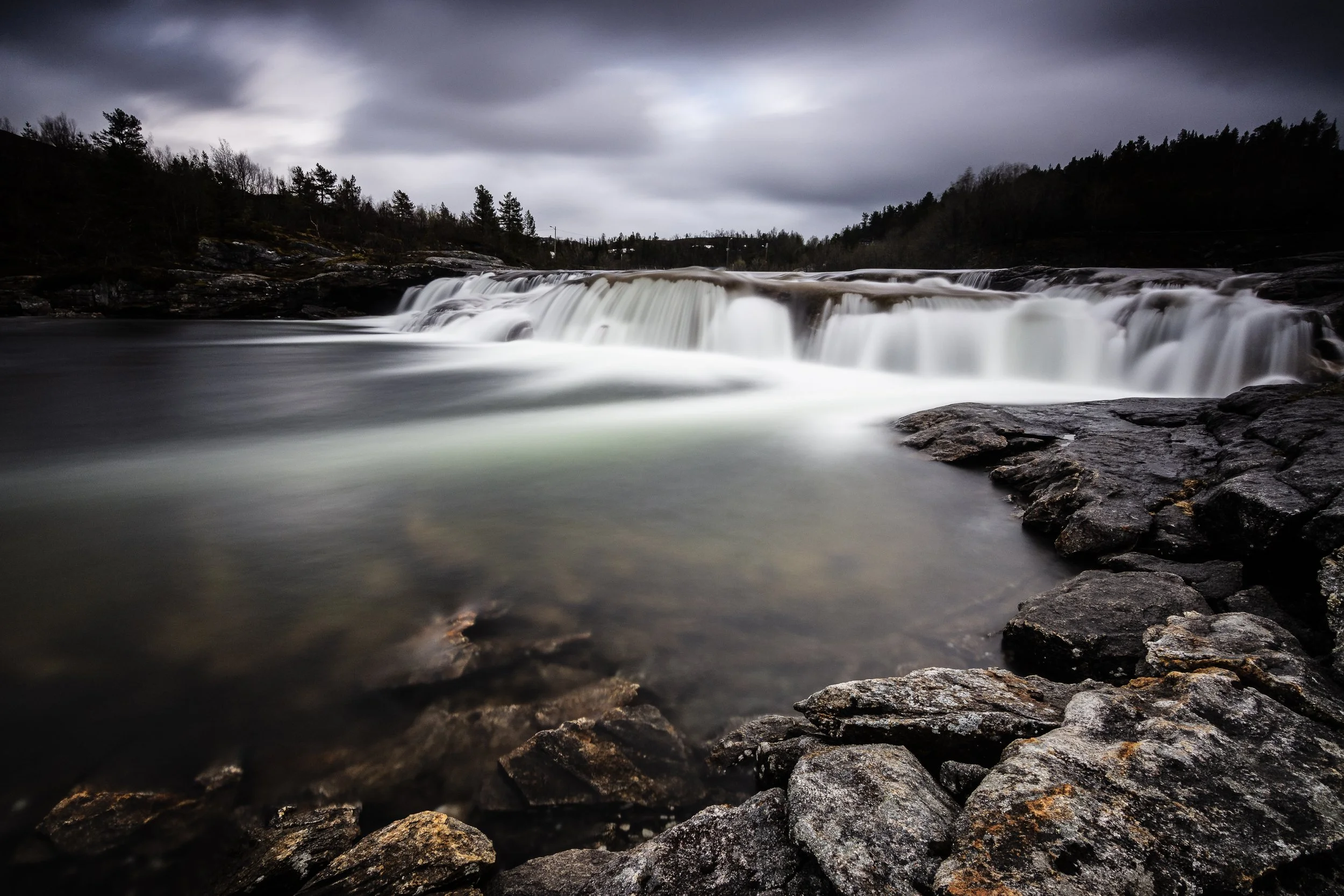
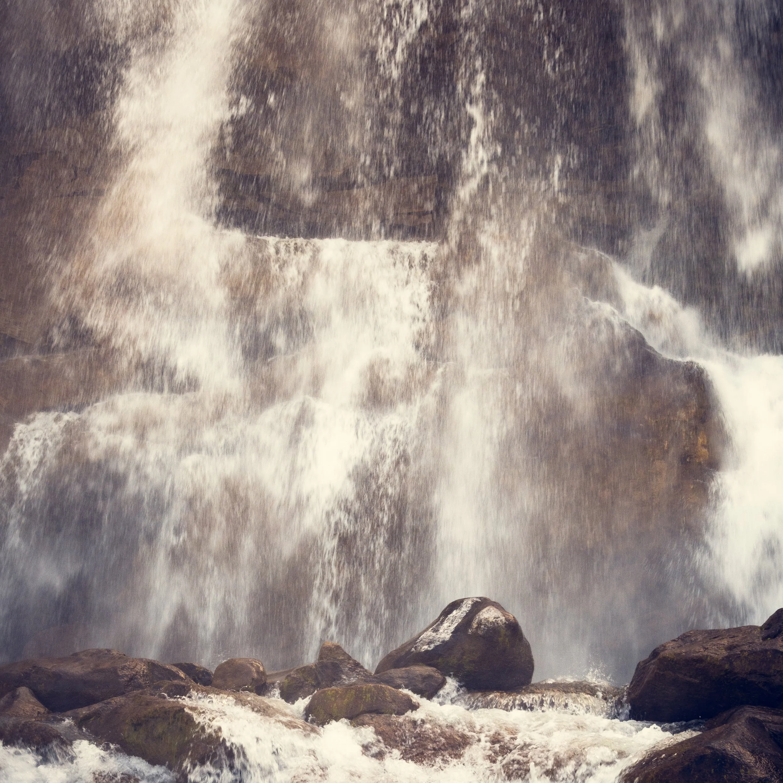
Saltdal: A small waterfall revealing its full character through careful composition, where camera position, framing, and exposure technique work together to emphasize movement, structure, and flow. Photo: Bjørn Joachimsen.
Saltdal provides open landscapes with strong directional lines. Junkerdalsura, by contrast, is sheltered and exceptionally fertile, with a unique botanical diversity due to its calcareous soil.
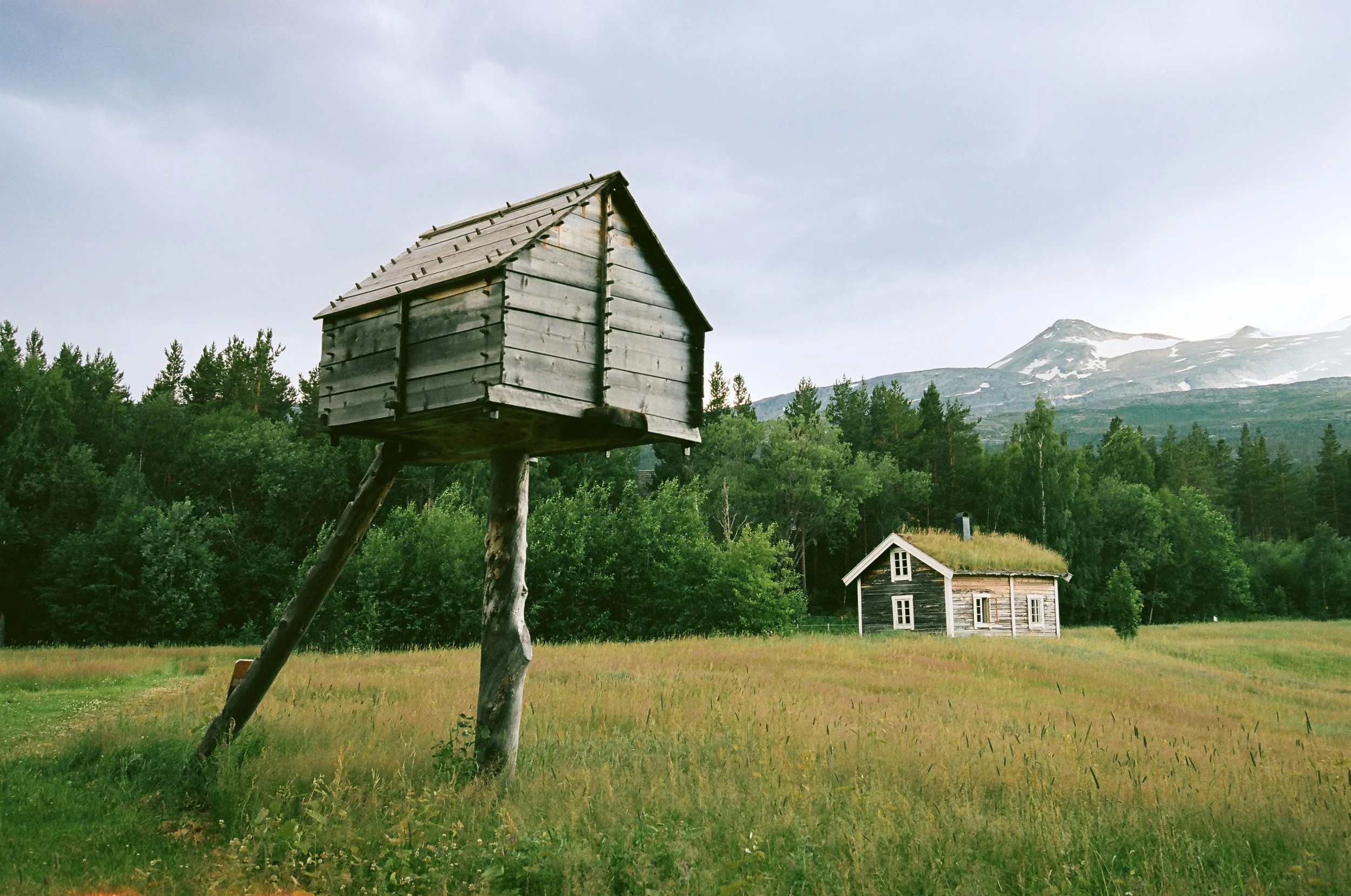
Saltdal: A traditional cultural landscape with historic timber buildings once inhabited by small-scale farmers engaged in sheep herding, cultivation, logging, and tar production. The distinctive raised storehouse in the foreground, known as a njalla, reflects a construction type historically used among minority communities across northern Scandinavia. Photo: Bjørn Joachimsen.
The area hosts a rare mix of southern and alpine plant species, including orchids such as Cypripedium calceolus and Epipactis atrorubens.
Several suspension bridges along the route provide additional photographic opportunities, hanging above the river and framed by birch forest.
In addition to standard lenses, a macro lens is highly recommended to take full advantage of the botanical richness.
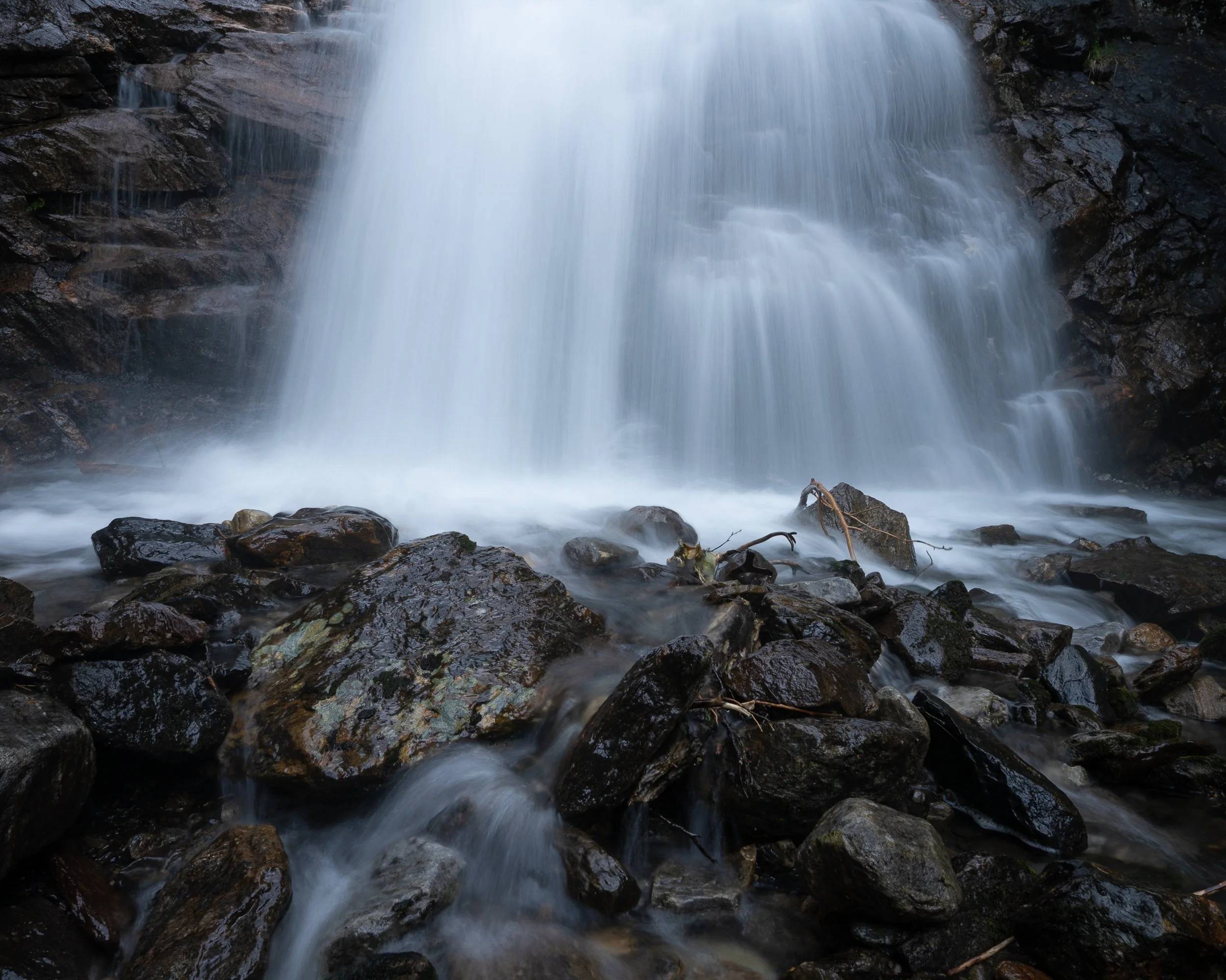
Saltdal / Salten: One of the region’s powerful waterfalls plunges down a near-vertical mountainside, transformed into a soft, flowing expression through long exposure. (Bronica SQ-Ai with Zenzanon PS 180mm, Ilford Delta 100.) Photo: Bjørn Joachimsen.
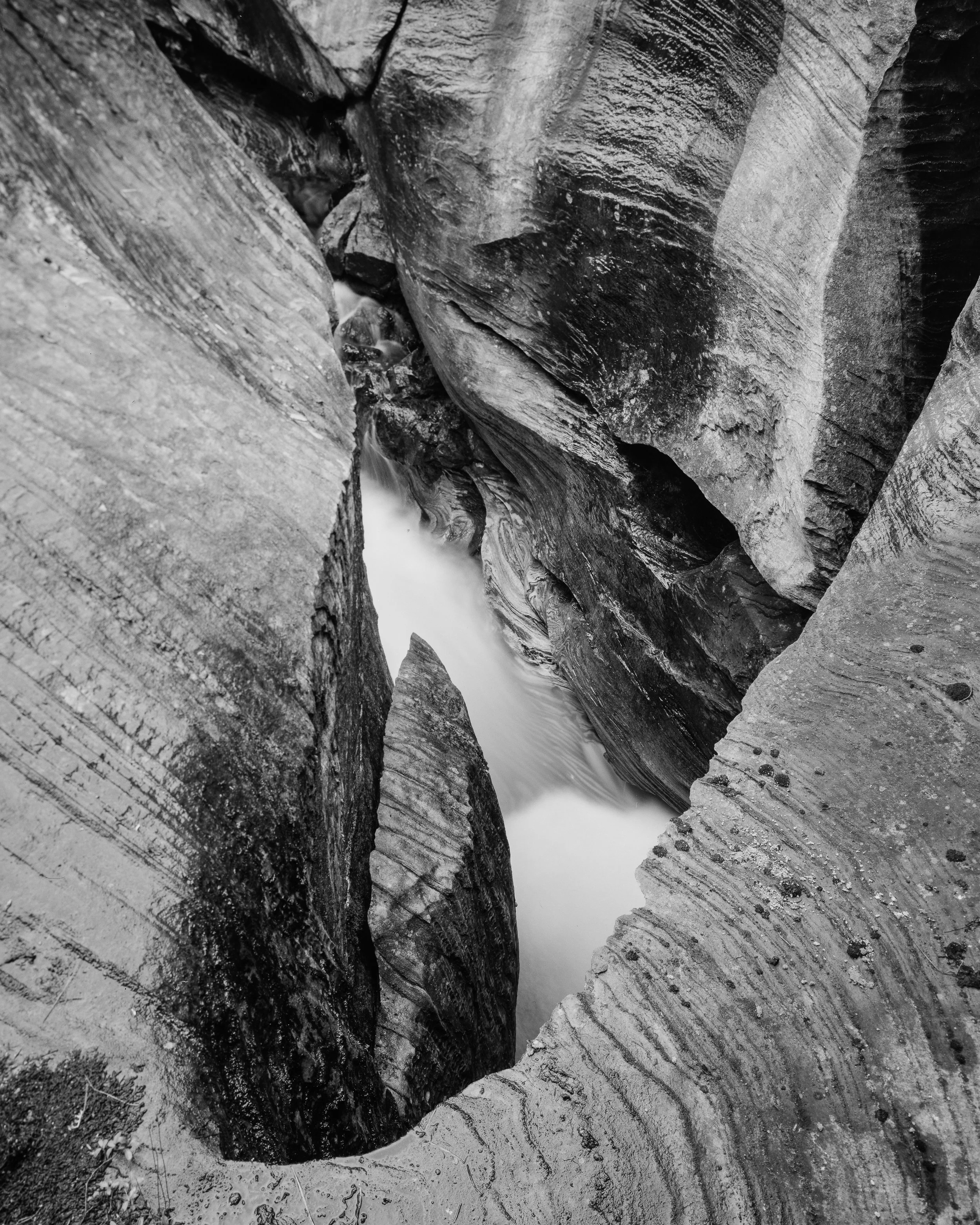
7. Valnesforsen
Valnesforsen combines accessibility with strong visual impact.
Valnes River: A stepped cascade rendered with long exposure, where flowing water creates rhythm and structure within a compact scene. This composition is captured with a wide-angle perspective to emphasize depth and movement. Photo: Bjørn Joachimsen.
A walk of approximately 1.6 kilometers leads through forest terrain to the waterfall, which drops around 60 meters — the largest in the Bodø area. During snowmelt or heavy rainfall, the water volume increases significantly.
Photographically, the key is balancing motion and structure. Shutter speed determines whether the water retains detail or becomes abstract. Surrounding elements add compositional depth.
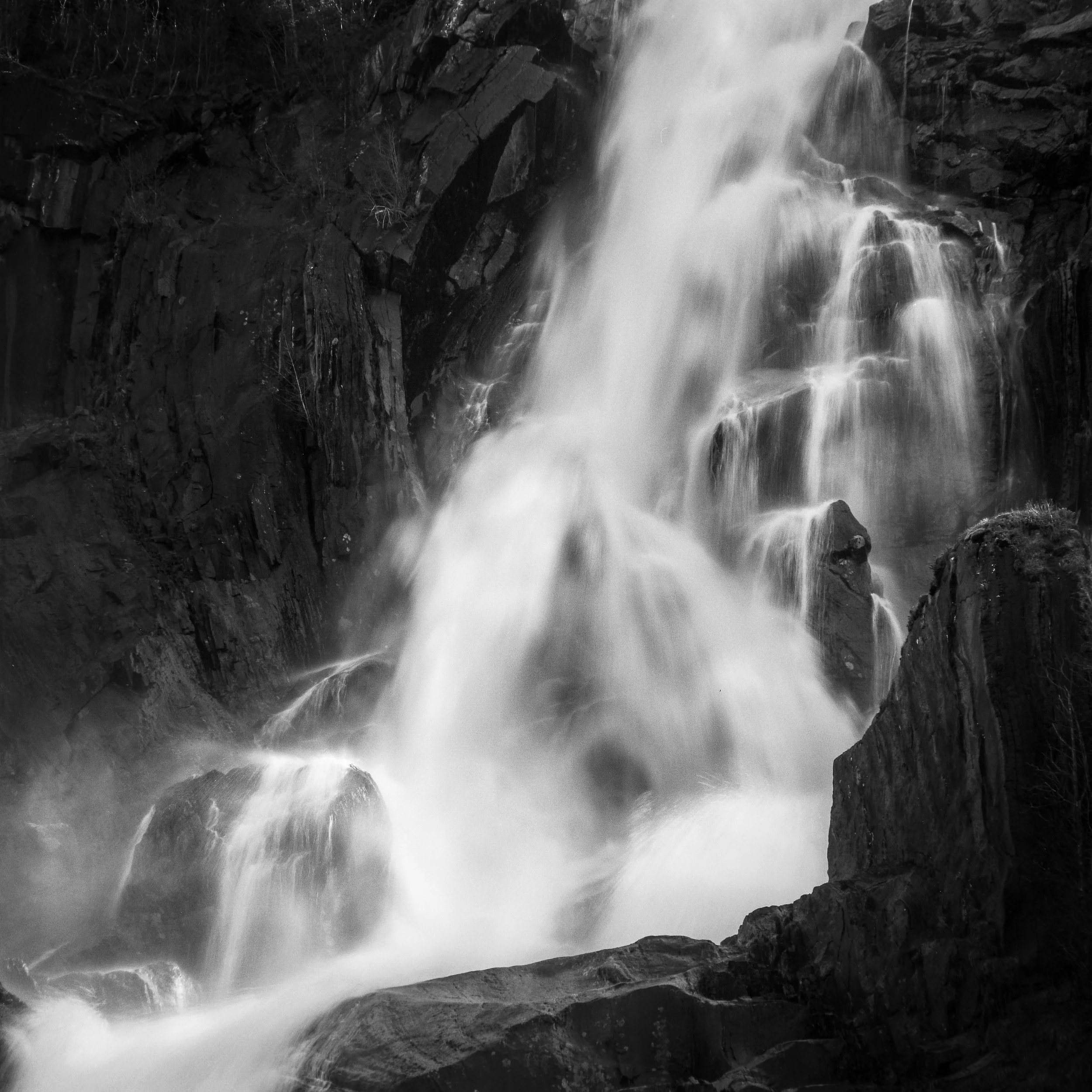
Valnesforsen (Valnes Waterfall): Powerful volumes of water plunge down the near-vertical drop, revealing the raw force of the falls. Using a telephoto zoom allows for tight, dynamic compositions that isolate structure, texture, and movement. Photo: Bjørn Joachimsen.
8. Sulitjelma – Smelter Ruins
Sulitjelma introduces a fundamentally different subject.
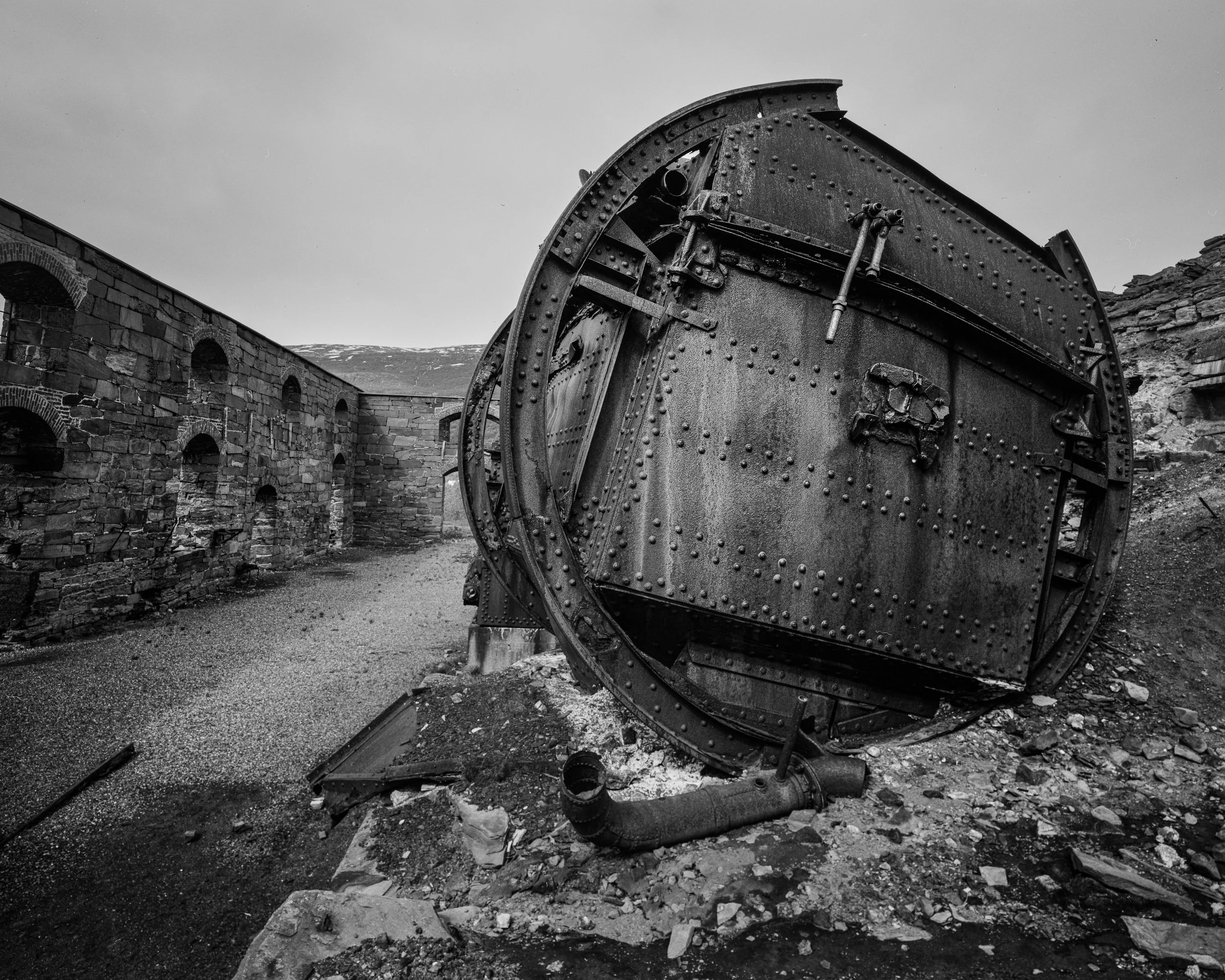
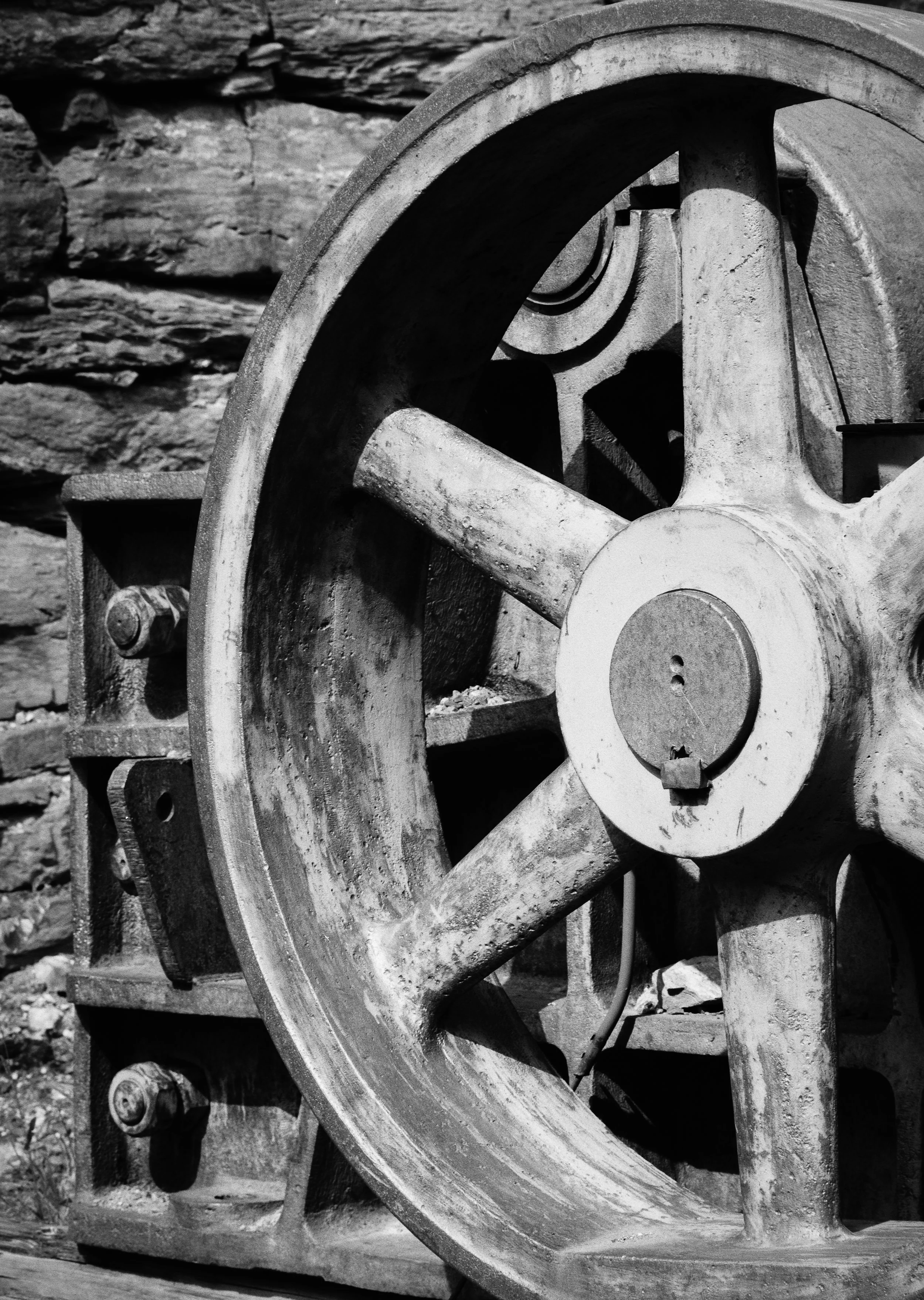
Sulitjelma: Remains of industrial equipment inside the smelter ruins, where rusted surfaces and rough textures create strong graphic elements and rich opportunities for detail-oriented compositions. Photo: Bjørn Joachimsen.
The remains of industrial activity create a landscape shaped by decay and time. Surfaces fragment, textures emerge, and structure becomes irregular.
Higher viewpoints near the upper sections of the smelter ruins allow for broader compositions, with the valley and lake in the background. At the same time, the area is rich in smaller details.
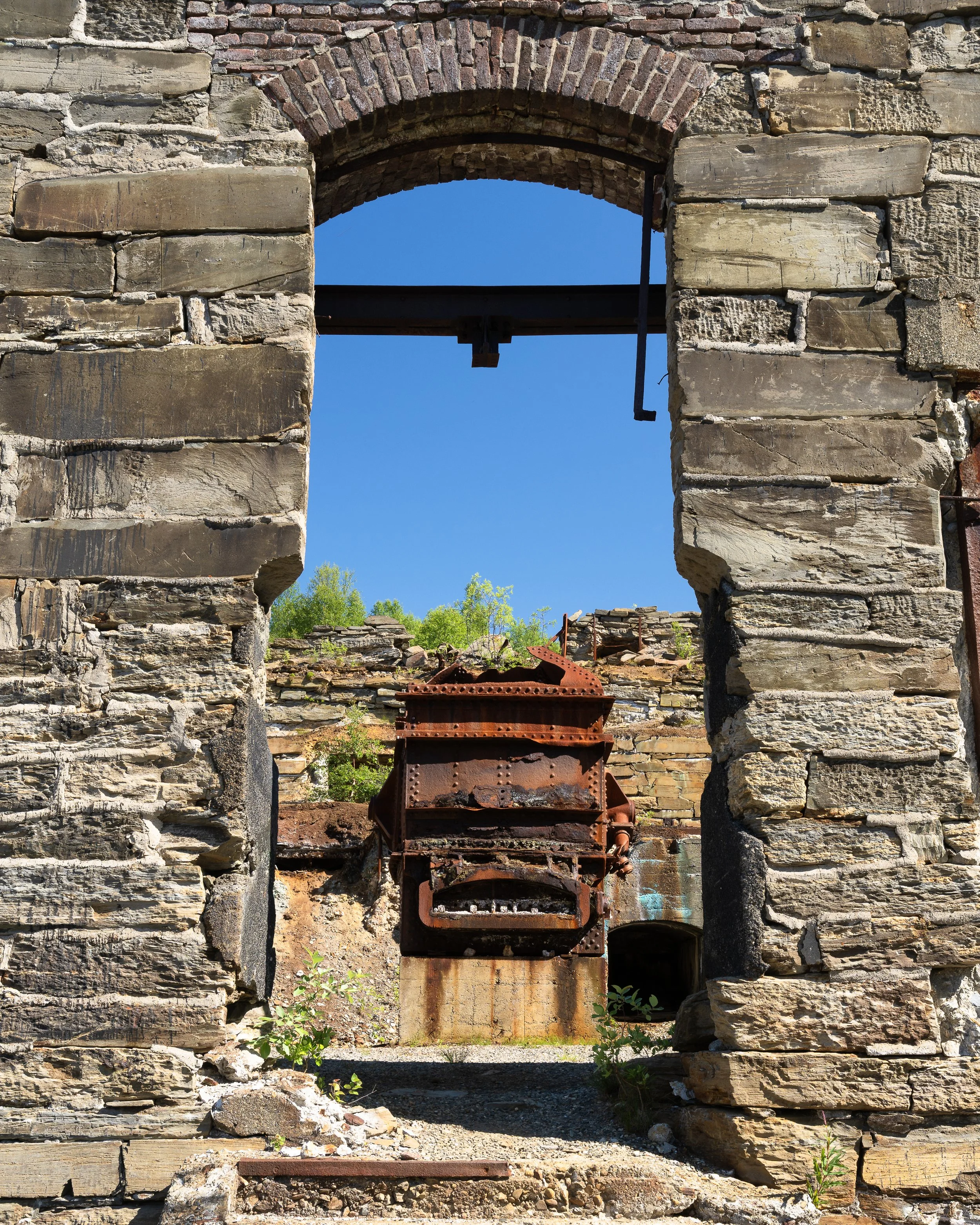
Nearby elements such as the river and old water intake pipes also provide strong photographic subjects.
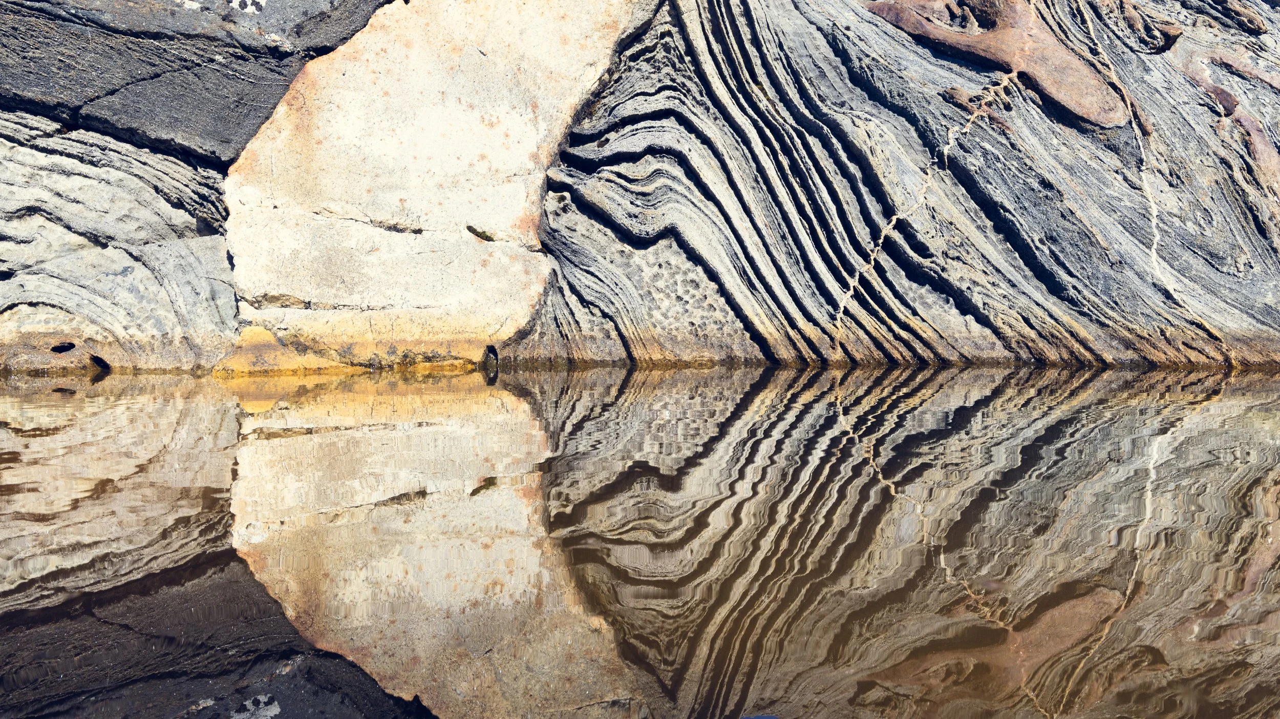
9. Bodø Coastline
The coastline around Bodø is subtle, but geologically rich.
A varied bedrock composition — including marble, limestone, mica schist, gneiss, amphibolite, and calcareous schist — creates complex patterns and textures along the shoreline.
Bodø / Salten: The unique geology of the region creates intricate forms and structures along the shoreline, here reflected perfectly in the still surface of the fjord. Photo: Bjørn Joachimsen.
These materials weather differently, producing flowing lines, fractured surfaces, and tonal variation that lend themselves to abstract compositions.
This is a location that rewards close observation rather than scale. Light plays a defining role, with low-angle light emphasizing structure and diffuse conditions simplifying the scene.
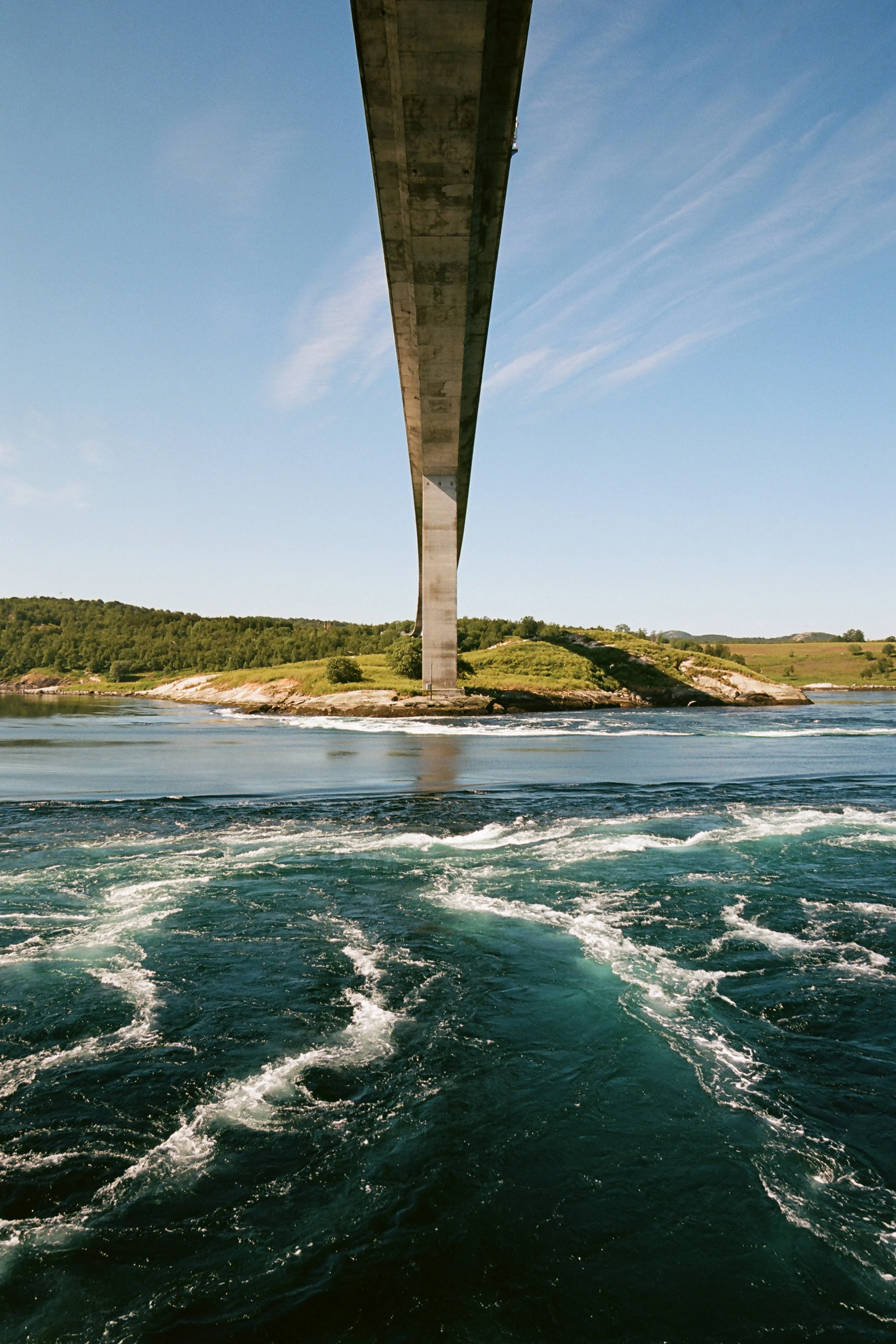
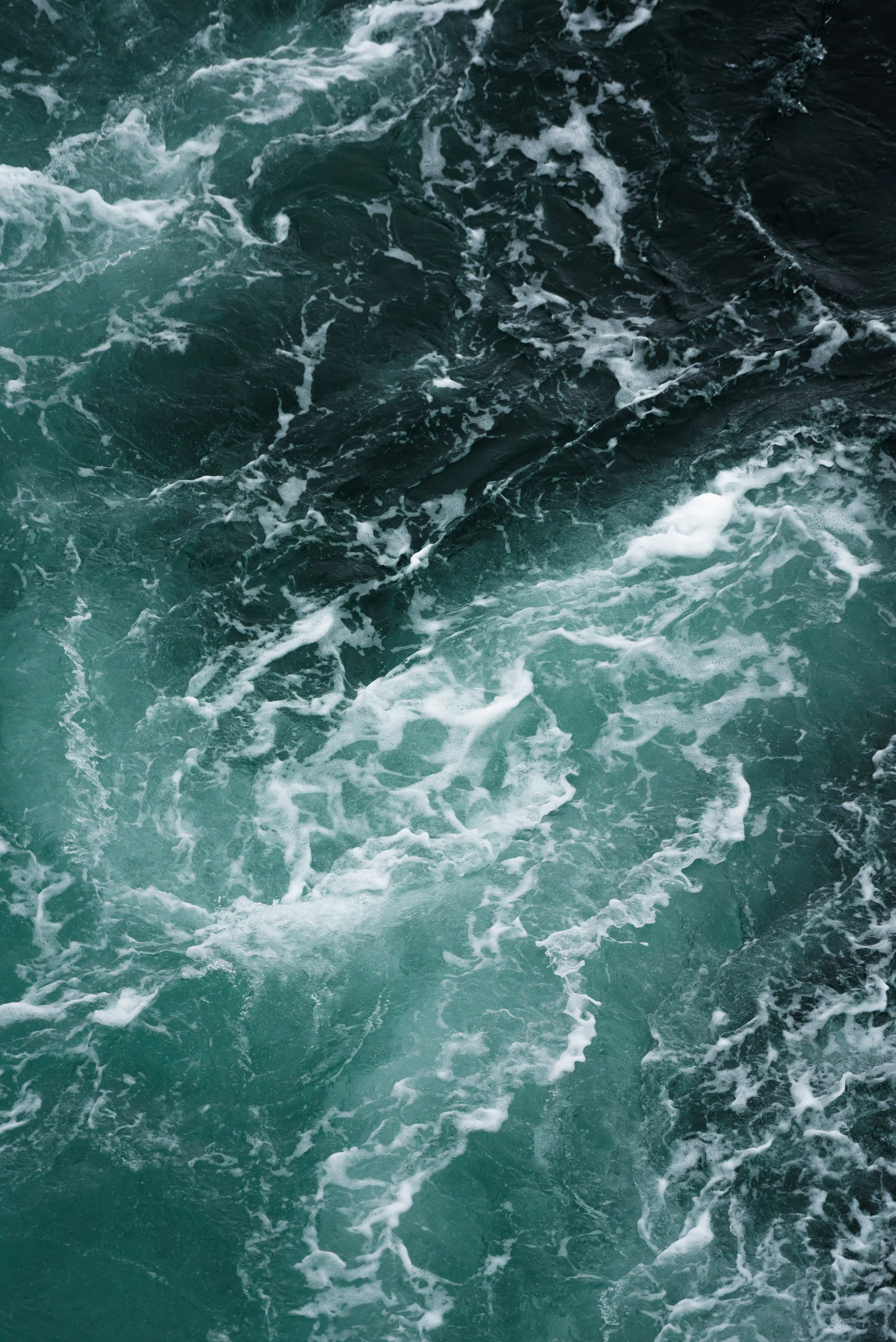
10. Saltstraumen
Saltstraumen is the strongest tidal current in the world.
Located between Straumøya and Godøya, it connects Saltfjorden and Skjerstadfjorden. Large volumes of water are forced through a narrow strait several times a day.
Saltstraumen: The world’s strongest tidal current, where vast volumes of seawater surge through the strait at remarkable speeds. The dramatic Børvasstindene mountain range provides a striking backdrop to the constantly shifting currents. Photo: Bjørn Joachimsen.
At peak flow — particularly around the new moon and full moon — the surface transforms into a dynamic system of eddies and whirlpools.
You can photograph from below the bridge using wide-angle lenses, or from above using telephoto lenses up to around 200mm for tighter compositions.
Timing is everything.
Give landscape the time it demands
Northern Norway is not defined by a single type of landscape, but by its transitions.
The strongest images rarely come from simply visiting a location once. They emerge through repetition, patience, and a willingness to adapt.
Many of these locations are highly dependent on timing — whether it is tidal movement, water levels, or changing light conditions. Others require slow observation and careful selection.
To work effectively in this region, it is strongly recommended to set aside at least one week. Not simply to cover the locations, but to engage with them — to return, to wait, and to refine your approach.
Landscape photography may be the starting point, but it is only one layer. Geological structure, botanical richness, water movement, and human traces all coexist within the same environments.
The most compelling images emerge when you remain open to all of it — and when you give the landscape the time it demands.
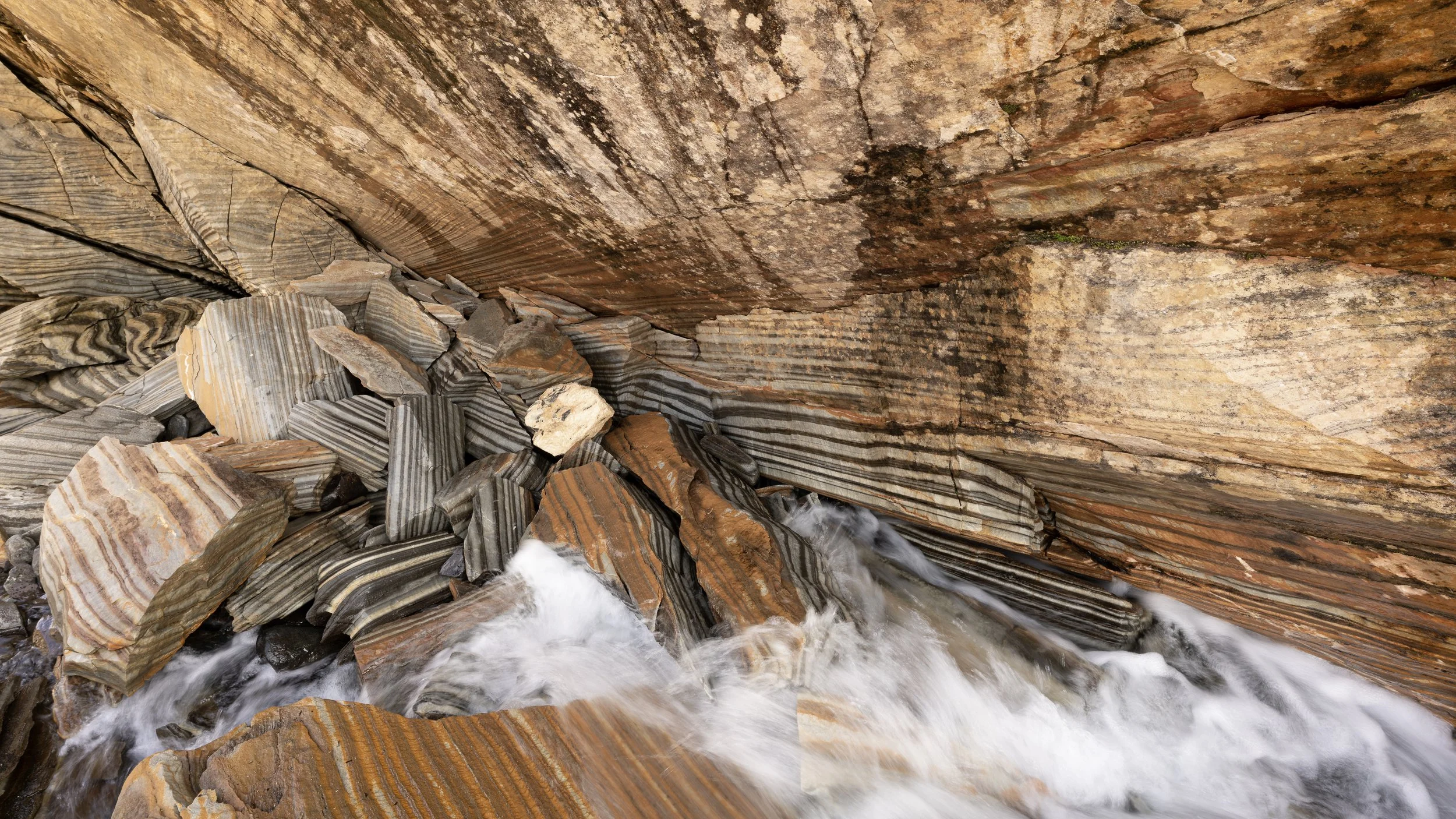
Láhko National Park: Fascinating karst formations created as blocks of marble have collapsed over time, forming complex structures and layered patterns across the landscape. Photo: Bjørn Joachimsen.
Northern Norway Photography Workshop in August
If this landscape speaks to you, we will be exploring Northern Norway during our Photography Workshop in August, where participants will have the chance to experience and photograph many of the region’s most remarkable locations together with us in the field.
Read more here: Northern Norway Landscape Photography Workshop, Aug 2–8, 2026